Summary: An area of low pressure will move into the region tomorrow night. High pressure will funnel cold air into our area, setting the stage for a high impact winter storm.
A strong area of low pressure will move towards our area, and pass by to our northwest tomorrow night through Wednesday. As it does, an area of high pressure will funnel cold air into our area. As a result, snow will develop over the state, before warmer air moves in aloft, changing it over sleet, freezing rain, and plain rain.
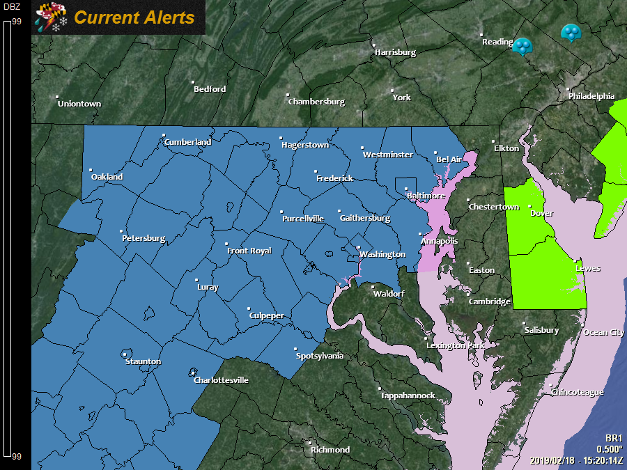
In anticipation of a high-impact event, the National Weather Service has issued a *Winter Storm Watch* for most of the state, west of the bay:
The system will move into our area during the early morning hours on Wednesday, and persist through the day, ending late Wednesday night or early Thursday morning.
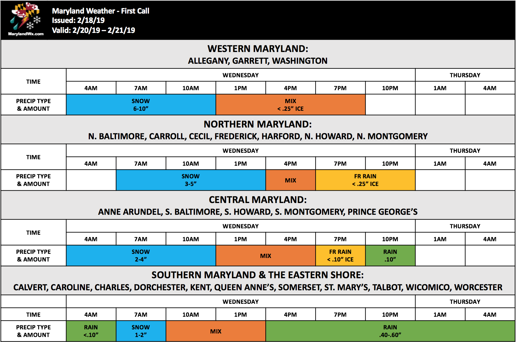
Since this storm will feature multiple precipitation types, and will affect different parts of the state differently, I have decided to produce a forecast timeline instead of a map. Here is my first call for each part of the state:
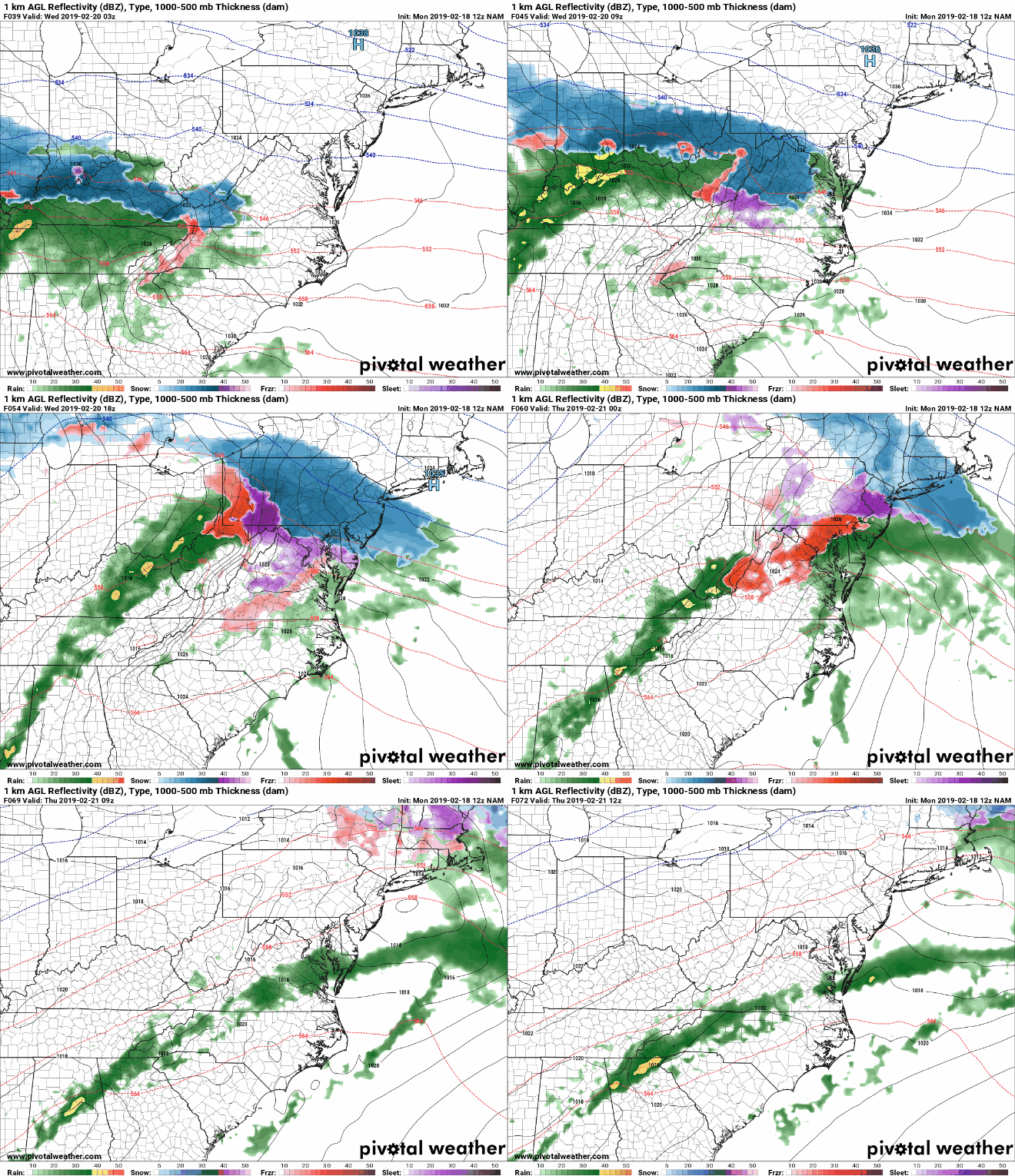
Here is this morning’s NAM that illustrates the general evolution of the storm and the various transitions in precipitation type:
This forecast will likely need fine tuning as we get closer to the event, and I will update this forecast as needed tonight and tomorrow as details come into focus.
Want the latest blog posts emailed to you?


