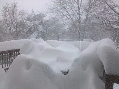
With 2 feet of snow still on the ground from this past weekends storm, another seemingly smaller storm was fast approaching the area. After digging out on Sunday, I began to look at the models and the possibility of more snow heading for the Mid Atlantic. This storm would be different however; it was looking to be a “Miller B” type storm.
A Miller A storm is a Nor’Easter that originates along the Gulf and moves up the coast, bringing snows to most of the East Coast.
A Miller B is a trickier setup. This type of storm originates in the Midwest, and redevelops somewhere along the coast and moves north from there. These storms need everything to work out perfectly for any one area to receive a major snowfall. Historically, for our area and south, it is even less likely as the low generally develops too far north to bring significant precipitation to our area.
Another added challenge to this storm was that there was very little model consensus. Most if not all models showed the Midwest low moving far enough south that we would possibly get a significant snowfall. Although each differed in the amount and the exact placement of the low. With a Miller B, any small difference can cause drastic changes to the forecast.
The National Weather Service had seen enough to issue a Winter Storm Watch on Sunday for 5 or more inches.
I continued to look at the data, searching for a reason why this storm would not work out, as they haven’t in the past. On Monday, the National Weather Service increased totals to 10-20 inches across the state.
On Monday evening, I issued my first forecast:
I had seen enough to now realize that this Miller B could be the rare snow producer for us. The storm was to come in two waves, first the overrunning upper level snow, which would be light, then after a lull, the coastal storm was progged to move in, giving us the bulk of our snow. My forecast had northern into northeast Maryland in a 12-18 range and tapered back to 4-8 inches for Southern Maryland and the Eastern Shore, where it looked as if sleet would mix in and cut down totals.
Late Monday, the models came in with even more moisture and better dynamics. I increased my totals to account for this and issued a second forecast on Tuesday morning:
Throughout the morning, the models began to show less snow and more uncertainty. The NAM model came in with a more northwesterly track and had the entire area changing to sleet, while also moving the heaviest precipitation northeast. Could this be be the “problem” that I was looking for or was it just a “bad run” of the model? This was enough of a red flag for me to lower my totals, although not too much as I didn’t want to throw out days of case building based on one model run. The National Weather Service kept their forecast for 10-20 inches, seemingly unfazed by this run.
This was my last forecast:
The snow started around 3:30 and it became apparent that the first part of the storm would be much more than the models had shown. This portion was supposed to give an inch or two of snow, but was actually putting down 7 inches in some areas. I measured 3.9 inches here at 10pm. By 11pm, something unexpected happened… we changed over to sleet and freezing rain. This meant that the southern storm was stronger and more northwest than anticipated, and perhaps the NAM was right.
As the second portion of the storm moved in, we changed back to snow as it pulled colder air back down into the area. The low was gathering strength to our south and Blizzard Warnings were posted across the entire state (something I had never seen before):
by 11:30am we had piled up 9.7 inches and the low was off Ocean City, Maryland, getting much stronger.
Here are two pictures during the near whiteout conditions:
The storm continued to slowly move north and it basically stalled as it bombed out off the New Jersey coast and continued to throw moisture and winds over 40mph over the region. The snow continued here until about 8pm, dumping a wind-whipped 19.2 inches in my backyard and 19.5 at BWI, shattering their record for snowiest season ever.
As for my forecast, it ended up being too low across the board. I did not anticipate how heavy the first part of the storm would be or how long the heavy precip would stay over the state on Wednesday. I figured the snow would gradually taper off on Wednesday, but due to the low bombing out the way it did, heavy snow and winds continued well into the evening. I did have the right idea about sleet mixing in, just not as far north as it did. I also had the right idea about totals dropping off just southwest of DC as Dulles only picked up 9.3 inches.
This Miller B was truly an amazing event here. Coming on the heels of another major storm and dropping as much snow as that one in some areas. The most amazing part for me was how quickly and how deep the low pressure strengthened. The low was moving north of Ocean City around 10am, and the pressure readings at my station bottomed out at 29.31″. As the storm moved north, my pressure went up to 29.33″, but even though it was moving away, my pressure again dropped to 29.27″ at 2pm, as the deepening was stronger than the effects of it moving away from my area. Truly an amazing event.
My season snowfall total now stands at 80.5″ and BWI is at a record 79.9″. This pattern looks to hold until we get into March so there should be more chances to add to this record, starting with another possible storm on Monday.


