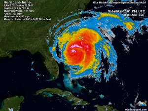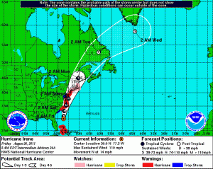
Hurricane Irene continues to track towards the Mid-Atlantic coast, about 400 miles south-southwest of Cape Hatteras, NC. Irene is moving north at 14mph and is expected to hit the Outer Banks tomorrow afternoon. From there, the storm is expected to continue up the coast and be on top of Ocean City by 2am Sunday morning with 100 mph winds. Hurricane Warnings are now in effect for Ocean City and Tropical Storm Warnings are in effect for Central Maryland and the Eastern Shore.
For tomorrow, showers and thunderstorms can be expected, increasing in intensity throughout the afternoon and into the night. Winds will be near 30 mph, gusting to 40 in central Maryland, while gusts to 50 are expected along the coast.
Tomorrow night, winds will increase to near 40 and gust to 50 in central Maryland while winds of 80 mph, gusting to near 100 can be expected in Ocean City. These conditions will continue into Sunday morning, before things wind down during the afternoon.
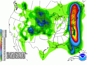
Rainfall totals will be anywhere from 2 to 4 inches west of the bay, with isolated spots over 6 inches. On the Eastern Shore, totals will be closer to 8 inches with isolated spots over 10 inches, especially close to the coast.
Take some time today to prepare for the storm. Expect widespread power outages, down trees and localized flooding.
Be sure to check the National Hurricane Center for the latest information. While there is high confidence in the track, it could still shift a little. Any small change in the track could cause significant changes to the forecast.
Here is a link to Weather Underground’s Wundermap centered over the Mid-Atlantic with the model tracks and official NHC track. It is a very good resource for tracking Irene’s progress up the coast.
Current Forecasts:


