A very active weather pattern is on tap through the holiday weekend, with several different systems poised to affect the area.
It starts with a warm front moving through the region today, followed by a cold front tonight. These two features will bring off and on rain to the area today and tonight. Another low pressure system will move through the area tomorrow and tomorrow night bringing more substantial rain. Highs today and tomorrow will be near 60 degrees, hardly feeling like the first day of winter!
After that system moves through, we clear out for Christmas Eve and highs return to the mid 40s. Christmas Eve night and Christmas Day are beginning to look a bit more interesting as there is building model consensus for another system to affect the area.
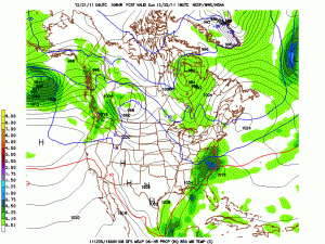
Right now, it looks like a coastal low pressure will develop and slide off of the coast Christmas Day. It looks to be a weak storm, and the cold air supply is lacking, but it bares watching as it may bring some light snow to the area.
Here is the GFS model forecast for Sunday afternoon, showing light snow over the state:

Things are still developing and will definitely change, so as always… Stay tuned!
