High temperatures will climb to the mid 50s today and tomorrow under partly sunny skies. We will dip back into the mid 40s on Sunday, thanks to a cold front passage.
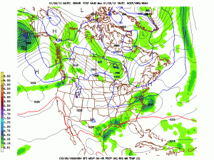
Sunday night and Monday are looking more interesting, as the models are starting to show an area of low pressure developing over Tennessee and moving to the northeast. Currently the GFS model is showing the possibility of 1-3″ of snow state wide.

At any rate, the setup isn’t perfect and the cold air will be marginal but it could bring the first inch of snow of the winter.
After that system moves through, a more potent coastal system looks to bring rain to the area as we move into midweek with temperatures in the upper 40s to low 50s. That system looks as though it will drag down another shot of cold Arctic air for next weekend.
