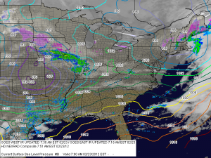
Tomorrow, a strong cold front will approach and move through the area, bringing a chance of showers and even stronger winds. Highs will be in the mid 60s and northwesterly winds of 20-25 mph could gust to 45 during the afternoon. Temperatures will begin to fall after the front moves through and we will return to near seasonal levels for the weekend. Highs Saturday and Sunday will be in the mid to upper 40s under mostly sunny skies.
Temperatures will begin to moderate back into the 50s as we head into next week and the beginning of March.
