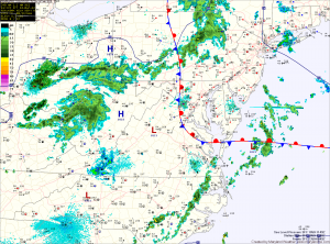
Expect the front to be pushed back to the east as an upper level disturbance moves through this afternoon, bringing with it a chance of showers and thunderstorms. Some of these showers and storms could produce locally heavy rain and gusty winds. Highs today will top out in the upper 60s to around 70 under partly sunny skies.
The rain threat will lessen as we head into tonight and skies will begin to clear. Expect another back door cold front to move in from the east, bringing clearing skies and highs in the mid 60s Saturday and Sunday.
We remain dry into next week and temperatures bounce back up into the 70s, to near 80 again for the latter half of the week.
