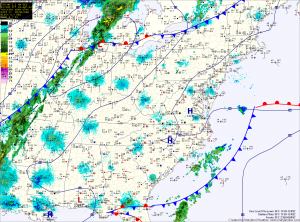
Today will be sunny and mild, with highs into the mid 70s. A cold front will approach from the west, reaching the state tomorrow. Ahead of the front, showers and thunderstorms will develop and move through the state tomorrow.
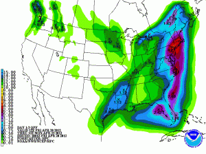
The front will stall along the coast as an area of low pressure moves northward along the coast. At this time, it appears the low will track close enough to the area to bring locally heavy rainfall, especially for the eastern part of the state on Sunday and into Monday.
Rainfall totals will drop dramatically from east to west and the exact track of the low will determine where the heaviest rains will fall. 
The low will move into New England and stall out early next week, continuing our unsettled weather. Expect a slight chance of showers and cooler weather into mid-week before the low finally begins to move out and high pressure works back in.
Expect a gradual warming trend as we move towards the latter half of next week and into next weekend.
