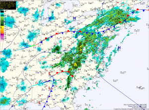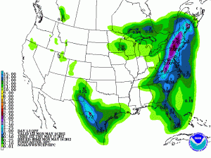
An area of low pressure to the southwest will continue to move slowly towards the area today. Ahead of the storm, southerly flow has brought deep moisture from the Gulf of Mexico northward. The presence of this moisture will combine with the storm to bring showers and thunderstorms to the state.
Expect several rounds of rainfall, heavy at times through tomorrow night. Rainfall totals of 1-3″ will be possible across the state, with the highest totals just west of the metro area.
Showers will continue moving into the area today, becoming steadier as we move towards this evening. Highs today will reach the low 70s.
Rainfall continues tonight, heavy at times. Lows will be in the low 60s.

Isolated to scattered showers and storms will be possible again on Wednesday as a cold front pushes through the area. Highs will push into the upper 70s before the front clears the state.
High pressure builds in for the remainder of the week and into the weekend, bringing a return to sunshine and temperatures in the mid 70s.
