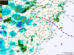
Deep tropical moisture remains over the region which means that any shower or storm that develops will again be capable of producing locally heavy rainfall. Highs today will be in the mid 80s.
As the remnant low of Isaac moves northeastward tomorrow, a cold front will approach the area from the west. This will keep a chance of showers and thunderstorms in the forecast. The storms will again be capable of producing heavy rainfall in a short period of time. Highs tomorrow will be in the mid 80s.
The front will stall out as it approaches the bay and will then slowly push eastward on Thursday. An afternoon thunderstorm will be possible before drier air moves in late Thursday. Highs Thursday will be in the mid to upper 80s.
Drier air settles in on Friday, with highs in the mid to upper 80s.
More showers and thunderstorms are expected over the weekend as another area of low pressure develops over the midwest.
