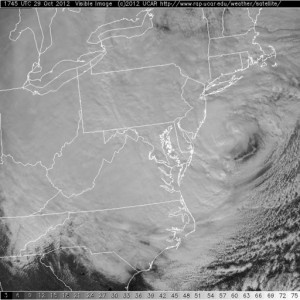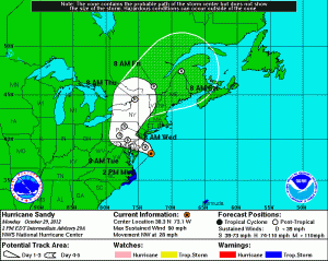
Winds remain at 90mph, but the pressure has dropped to 940mb (27.76″) and the storm is accelerating towards the coast at 28mph.

The storm is then expected to move to just north of Baltimore by tomorrow morning, as it weakens to Tropical Storm strength.
It will continue to move west-northwestward into Pennsylvania through the day tomorrow and eventually turn northward into northern Pennsylvania and southern New York by Wednesday morning.
Conditions will continue to deteriorate this afternoon and the worst of it will hit tonight through tomorrow morning.
Winds and rain will slowly wind down late tomorrow morning into tomorrow afternoon, but will still gust to near Tropical Storm force into tomorrow evening.
