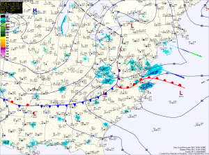
Last night’s clipper brought a dusting to northern parts of the state, while nearly 5 inches of snow fell across southern St. Mary’s county. Totals across central Maryland of 1-2″ were common.
The next system will have a bit more moisture with it, but will be a fast mover. Expect snow to develop during the afternoon and last into tomorrow night. Snowfall totals of 1-3″ are expected at this time, impacting the evening rush hour.
Behind that system, a cold and dry weekend is on tap. Highs on Saturday will push to near freezing, pushing into the mid 30s on Sunday.
We will see a warming trend as we head into next week. Highs will climb to near 40 on Monday and may approach 50 towards midweek. We will also have several systems that will bring rain to the region.
Yesterday’s Weather Station Stats:
High Temp: 24.8°
Low Temp: 12.1°
Rain: 0.00″
