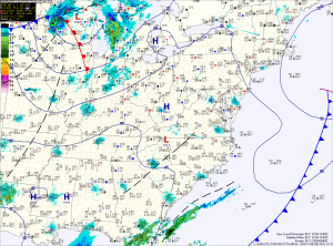
Clouds will increase tomorrow as two cold fronts pass through. The models are showing signs that an area of low pressure will develop along the second front late Friday, bringing another round of rain to snow during the overnight. The possibility exists for another light accumulation by Saturday morning.
Behind the fronts, it will turn sharply colder this weekend. Highs Saturday will be around 40 and will only reach the low to mid 30s on Sunday.
Next week begins dry, but an area of low pressure will drag a cold front through the region on Tuesday, bringing a chance of rain.
Yesterday’s Weather Station Stats:
High Temp: 45.0°
Low Temp: 27.1°
Rain: 0.18″
