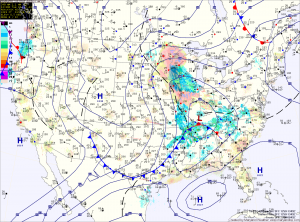
Currently, a Winter Storm Warning is in effect for Allegany, Frederick, Garrett and Washington counties. A Winter Storm Watch remains in effect for the rest of the state west of the Bay.
Precipitation will overspread the state from west to east this afternoon and evening. In the mountains, it will start as snow, while further east, rain will develop and slowly transition to snow during the overnight.
By tomorrow morning, all areas west of the Bay will have transitioned to snow. Areas around and east of I-95 may mix with rain at times tomorrow morning, but the snow will continue, heavy at times through the day and into tomorrow night. Lower southern Maryland and the Eastern Shore will see more rain and have more mixing, cutting down storm totals. By tomorrow night, even these areas will see a period of all snow before it begins to taper off.
This is an extremely tough forecast. The snow will have to overcome marginal temperatures and a stronger March sun angle to accumulate as well as any shift in the storm track that would bring in colder or warmer air. Currently, it appears snowfall totals will range from over a foot in Garrett county, to about an inch across the lower Eastern Shore.
Projected Snow Totals by County:
12+”: Garrett
8-12″: Allegany, Washington
6-10″: Frederick, Carroll, Montgomery, Howard, N. Baltimore
4-8″: Anne Arundel, S. Baltimore, Baltimore City, Cecil, Harford, Kent, Prince Georges
2-4″: Calvert, Charles, Queen Annes, Talbot
1-3″: Caroline, Dorchester, St. Marys, Wicomico
Trace-1″: Somerset, Worcester
The snow will wind down Wednesday night into Thursday morning. Highs Thursday will be in the upper 30s with strong northwesterly winds.
The end of the week and the weekend will feature mostly sunny skies and temperatures warming into the mid 50s by Sunday.
Yesterday’s Weather Station Stats:
High Temp: 43.1°
Low Temp: 27.7°
Rain: 0.00″
