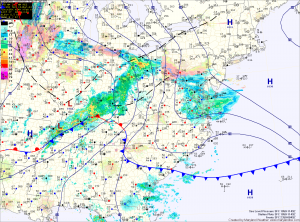
The exception is far western Maryland, where a Winter Storm Warning is in effect for several inches of snow. Further east, accumulations are not expected. Highs today will top out in the mid to upper 30s.
The cold front will pass through tonight, bringing an end to the precipitation. Tomorrow will feature decreasing clouds and gusty winds. Highs will be in the low 50s.
Cool conditions will arrive on Wednesday and persist through the end of the work week. A weak area of low pressure may bring a sprinkle of flurry on Thursday, otherwise, no precip is expected. Highs will be in the mid to upper 40s Wednesday through Friday under mostly sunny skies.
We warm a bit as we head into the weekend, ahead of the next storm system. Highs on Saturday will push into the low 50s.
Another area of low pressure may bring rain to the region late Sunday or Monday.
Yesterday’s Weather Station Stats:
High Temp: 41.2°
Low Temp: 33.5°
Rain: 0.00″
