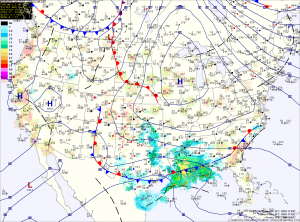
High pressure moves overhead tomorrow, calming winds and continuing the sunshine. The high will move off the coast during the afternoon and high clouds will begin moving in, ahead of low pressure to the south. Highs will be in the low to mid 50s.
Low pressure will move along the southeast coast then up and off the Carolina coast. Rain will move in overnight Thursday and continue through Friday morning. As the low moves away Friday afternoon, the rain will taper off and end during the late afternoon. Highs Friday will be in the mid to upper 50s.
High pressure builds back in for the weekend and then moves off the coast as we move into next week. As it does, southerly flow will develop and temperatures will climb. Highs Saturday will be in the upper 50s, warming to near 70 on Sunday.
Typical for this time of year, a backdoor cold front from the northeast may hold temperatures down next week. If the front does not make it into the area, highs early next week will likely top 70 degrees.
Yesterday’s Weather Station Stats:
High Temp: 49.9°
Low Temp: 28.7°
Rain: 0.00″
