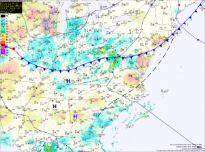
High pressure takes control this weekend. Expect mostly sunny skies both Saturday and Sunday with highs in the low 80s both days.
The high will push off the coast as we move into next week, allowing temperatures and moisture to increase. Monday will feature more clouds than the weekend with highs pushing into the mid 80s.
Temperatures will continue to warm Tuesday and Wednesday as will shower and thunderstorm chances. Isolated storms are possible Tuesday afternoon as highs push into the upper 80s. Isolated to scattered storms are also possible on Wednesday as a cold front approaches. Highs will be near 90 degrees.
The front should clear Wednesday night, bringing another round of quiet and cooler weather for the last part of the week.
Yesterday’s Weather Station Stats:
High Temp: 90.5°
Low Temp: 71.2°
Rain: 0.01″
