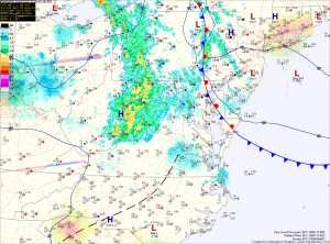
The front will push southward overnight and into the Carolinas tomorrow. As a result, expect a mix of clouds and sun tomorrow with highs in the mid 80s.
High pressure will build in Friday, bringing a return to mostly sunny skies. Highs will be in the mid 80s.
Saturday and Sunday will have a more typical summer-like feel as high pressure moves off the coast and southerly flow develops. The resulting warmer air and higher humidity will support an isolated thunderstorm chance both afternoons. Highs will be in the mid to upper 80s.
A cold front will bring a better chance of showers and thunderstorms on Labor Day. Behind that front, another round of drier and cooler air is expected.
Yesterday’s Weather Station Stats:
High Temp: 91.1°
Low Temp: 72.3°
Rain: 0.00″
