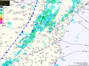
Temperatures are already near 70 and will top out in the low 70s before dropping a bit behind the front.
An upper level trough will swing through tomorrow, bringing a reinforcing shot of cold air and clouds to the area. A few showers are possible in the mountains. Highs will be in the mid 60s under partly sunny skies.
High pressure will build in on Sunday accompanied with gusty northwest winds. Highs will only be in the low 50s.
High pressure will persist into next week, leading to dry and cool conditions through Tuesday.
Another cold front may bring rain Wednesday night or Thursday.
Yesterday’s Weather Station Stats:
High Temp: 69.3°
Low Temp: 51.0°
Rain: 0.02″
