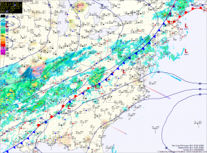
Tomorrow, we will be between systems. Today’s cold front will be to our south allowing cold high pressure to work into the region. Meanwhile, another area of low pressure will be approaching from the southwest. This system will bring a wintry mess to the area on Sunday. Highs tomorrow will be in the low 40s under partly sunny skies.
The low pressure system will spread moisture into the area by late Sunday morning. The storm will be passing by to our west which will put us on the warm side as southerly flow brings warmer air into the region. As it does, high pressure to our north will continue to funnel cold Canadian air down the coast east of the mountains. This cold air will become trapped in a classic cold air damming scenario.
Currently it appears that enough cold air will be present at all levels to support the precipitation starting as snow. Several inches of snow are likely, especially west of I-95. During the day on Sunday as warmer air continues to work in aloft, the snow will change to sleet and then to freezing rain. Right now, freezing rain looks to be the predominant precip type. Several hours of freezing rain now appear likely Sunday afternoon into Sunday night. The freezing rain should change to plain rain late Sunday night, from east to west.
East of I-95 should warm above freezing shortly after midnight, while areas to the west will change over during the early morning hours on Monday. By dawn on Monday, most areas should be above freezing. This is shaping up to be a significant ice event for the area before temperatures warm above freezing on Monday. Be sure to stay up to date with the latest forecasts and weather watches and warnings today and tomorrow. I will post short updates on the message box on the front page of the website through the storm.
The rain will continue through Monday and into Monday night, possibly ending as sleet or snow as colder air moves back in behind the low.
After the system clears out, expect a dry and very cold stretch through mid week with highs in the low 30s Tuesday and Wednesday.
Yesterday’s Weather Station Stats:
High Temp: 65.8°
Low Temp: 49.4°
Rain: 0.00″
