
A Winter Weather Advisory has been issued for: Garrett and Western Allegany counties.
A Wind Chill Advisory has been issued for: Garrett county.
A Wind Advisory has been issued for the entire state except Garrett county.
Today will see a mix of clouds and sun with an isolated snow shower possible. Highs be in the mid 30s.
Tomorrow will be mostly sunny, windy and cold with highs only reaching the mid to upper 20s.
An area of low pressure will approach from the southwest on Sunday. This low will track south of the area Sunday evening into Monday spreading wintry precipitation into the state.
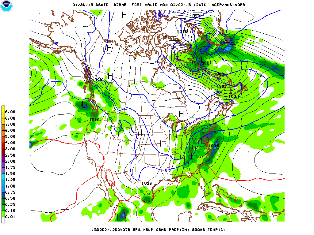
Was this a temporary bump in the track or is this a more likely scenario? That is the question that will hopefully be answered with today and tonight’s model runs.
Right now, it appears snow will begin late Sunday afternoon or evening and continue into Sunday night before possibly mixing with or changing over to sleet and freezing rain. As the storm moves eastward, colder air would work back in Monday morning to change the mix back over to snow before ending sometime Monday afternoon.
Behind that system, another shot of very cold air will follow, with lows in the single digits Monday night and highs on Tuesday in the mid 20s.
The remainder of the week looks cold, with a slight chance of snow again Wednesday night into Thursday.