
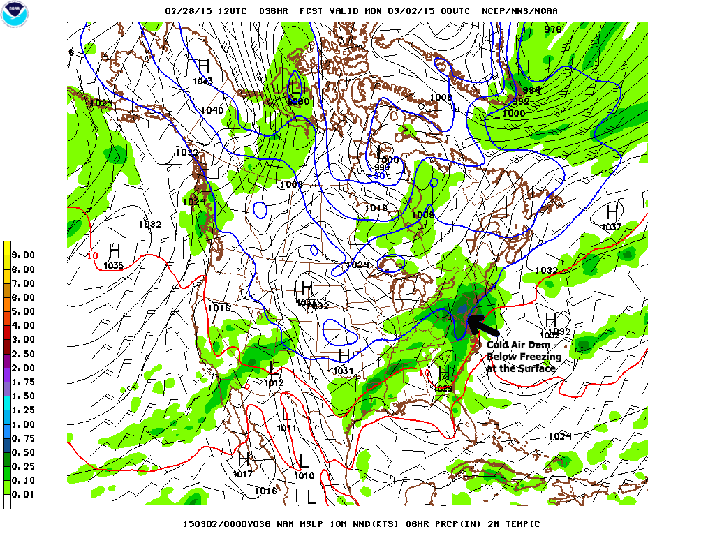
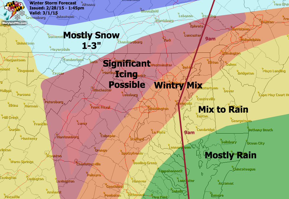
After reviewing the afternoon models, the threat for significant icing remains for parts of our state. This is a very complicated forecast due to the variety of precipitation types that we are likely to see.
Initially we will be below freezing at the surface and aloft so the precipitation will start as snow across most areas except the lower Eastern Shore where it will likely be rain.
The sleet will then slowly change to freezing rain from south to north during the evening and overnight hours. Most areas west of the bay will likely remain below freezing through the night, leading to accumulations of sleet and freezing rain.
Areas north and west of I-95 are most likely to stay below freezing and significant icing is possible.
One saving grace will be the high sun angle. This will help warm surfaces during the daylight hours, cutting back on potential ice accumulation but at any rate, with temperatures below freezing, icing is likely especially Sunday night before the storm moves out early Monday morning.
I will refine this forecast tomorrow morning as the exact details come into focus.