
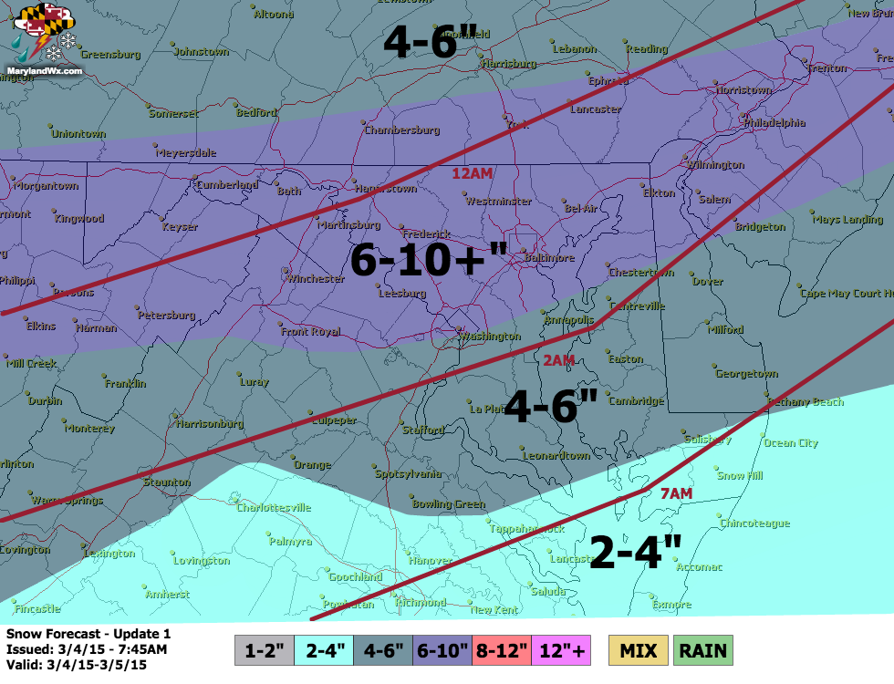
– Winter Storm Warnings continue for the entire state
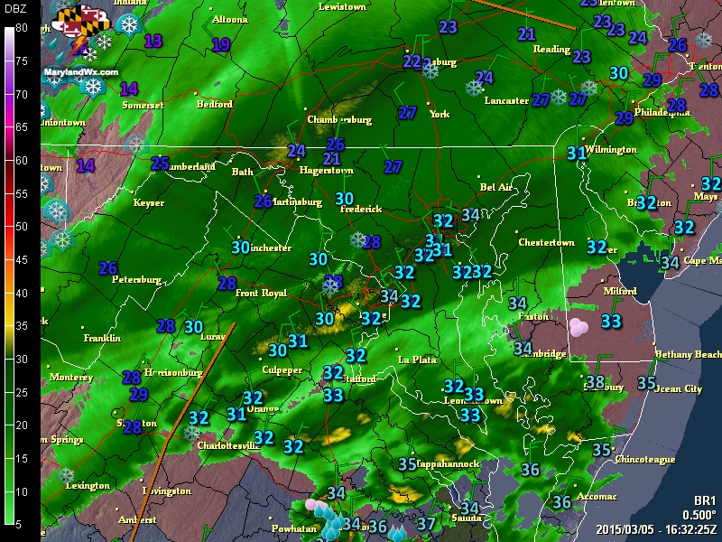
Snowfall rates of 1-2″ per hour are likely for the next few hours.
We currently have 2.25″ of snow here in Millersville and reports into the National Weather Service indicate that it is really beginning to pile up, especially north and west of I-95 with the highest report so far being 6.5″ in Carroll county.
Temperatures have been right around freezing this morning but are beginning to fall into the 20s and will continue to fall through the 20s this afternoon and evening. With a fresh snowpack, record lows are likely tonight with lows falling into the single digits to low 10s by tomorrow morning.
I will have another brief update in a few hours to status the storm and report some more totals.
Stay up to date with storm information on your favorite social media site!
Follow me on Twitter, Facebook and Google+!