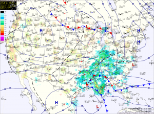
Before the rain arrives, expect increasing clouds today with highs around 50°.
Rain will overspread the state this evening, from west to east and become steady overnight. Steady rain will continue into tomorrow afternoon before tapering off during the afternoon and evening hours. In total, rainfall between .75″ and 1″ are likely. It will be warmer, with highs likely reaching the low 60s.
High pressure will build in on Sunday allowing sunshine to return. Highs will be in the mid 50s.
Monday will be sunny and mild, with highs around 60°.
A cold front will likely pass through late Monday, dropping temperatures a bit on Tuesday. Highs will be in the low 50s.
We should remain mostly dry for the remainder of the work week with highs generally in the 50s Wednesday through Friday.
Stay up to date with storm information on your favorite social media site!
Follow me on Twitter, Facebook and Google+!
