
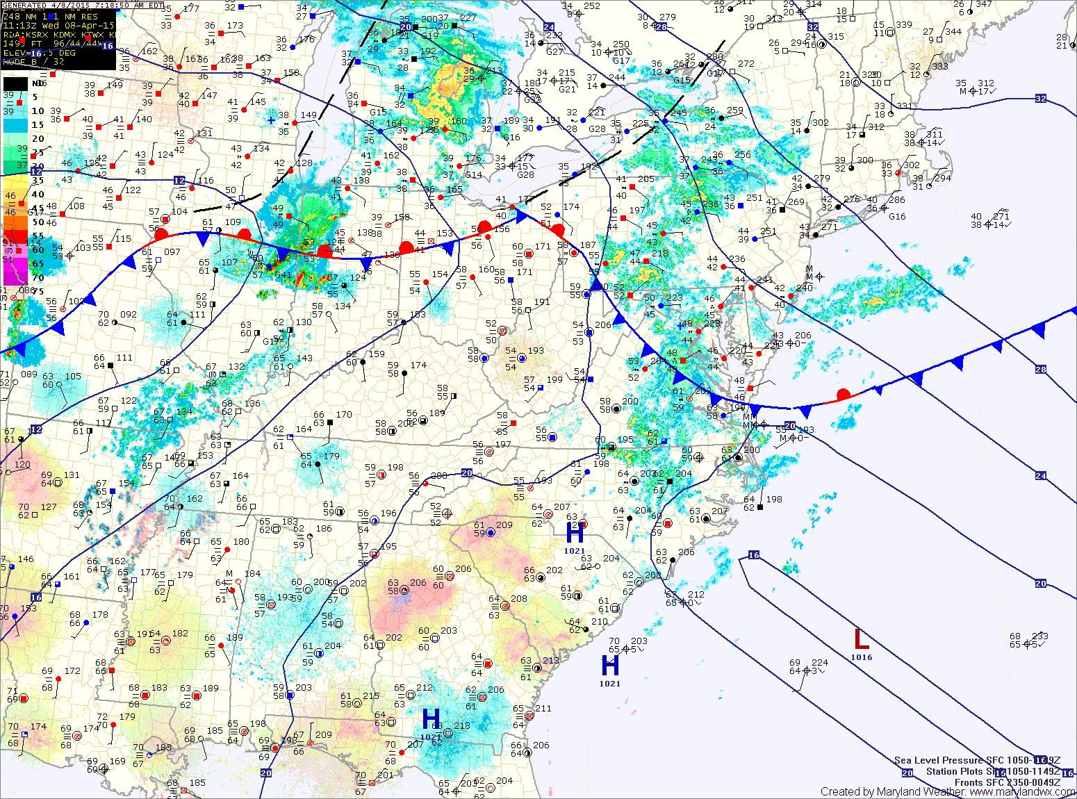
Showers will continue this morning as the latest batch moves through. There will be a lull in the rainfall this afternoon but it will remain cloudy and damp. Highs will only reach the mid to upper 40s.
Another area of rainfall is likely to push through this evening and tonight as the front remains south of us. Drizzle and misty conditions will persist into tomorrow morning as we remain in the marine air. Expect more scattered showers during the afternoon and evening hours, with highs in the upper 40s to around 50°.
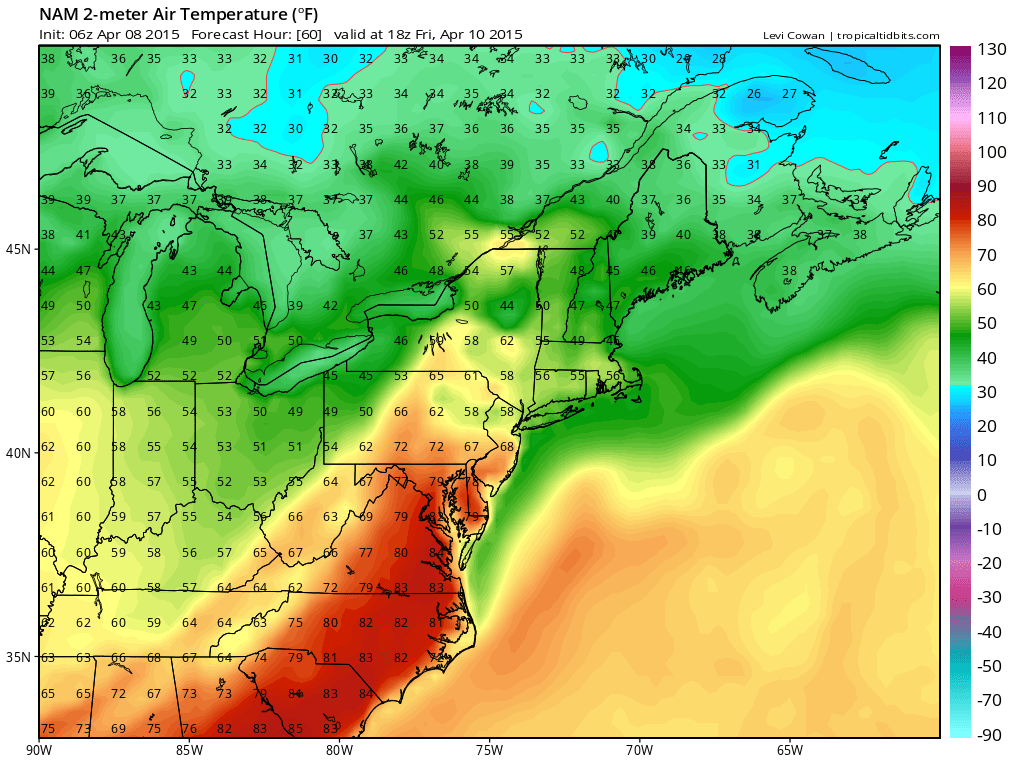
Southerly flow will intensify behind the warm front and ahead of the cold front, pushing temperatures back into the 70s to near 80° by Friday afternoon.
Ahead of the cold front, scattered showers and thunderstorms are likely, mainly during the afternoon and early evening hours. Some of the storms could be severe, with damaging winds and large hail the primary concern.
The front will push through late Friday evening, ushering in drier air for the weekend. Saturday and Sunday will be mostly sunny, with highs in the mid 60s each day.
Stay up to date with storm information on your favorite social media site!
Follow me on Twitter, Facebook and Google+!