
High pressure continues to sit off of the coast, keeping hot and humid air over our region. A weak frontal boundary will be in the area through this weekend.
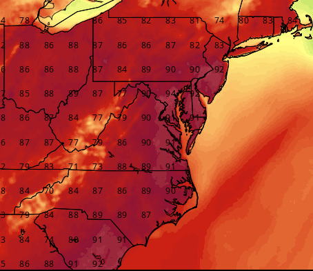
Highs today will reach the low 90s once again, with isolated afternoon and evening thunderstorms possible.
SATURDAY: With a frontal boundary in the area, expect scattered afternoon and evening thunderstorms. Some of the storms could turn severe, with damaging winds being the primary threat. Highs will be in the upper 80s to low 90s.
SUNDAY: The front will slide to our south allowing a slight break in the heat. Highs will be in the mid to upper 80s under mostly sunny skies. An isolated pop up shower or thunderstorm cannot be ruled out during the afternoon and evening hours.
MONDAY: Another weak frontal system will push into the area, keeping showers and thunderstorms possible. Highs will be in the mid 80s.
OUTLOOK: The front will remain in the area Tuesday into Wednesday before sliding southward. Showers and thunderstorms will be possible throughout the period. Another system may affect the state later in the week.
Stay up to date with storm information on your favorite social media site!
Follow me on Twitter, Facebook and Google+!