
A stalled out front along the coast will be the focus of rain activity today through Saturday while Hurricane Joaquin tracks up the coast Sunday and Monday.
(tropicaltidbits.com)
The rain will be heaviest Friday afternoon and into the evening before tapering off Friday night into Saturday. Scattered showers are likely on Saturday as well.
It will also be cool and breezy during this period, with highs around 60° today, only in the mid 50s tomorrow and then mid 60s on Saturday. Northeast winds will gust to near 20 mph today and near 30 mph tomorrow and Saturday.
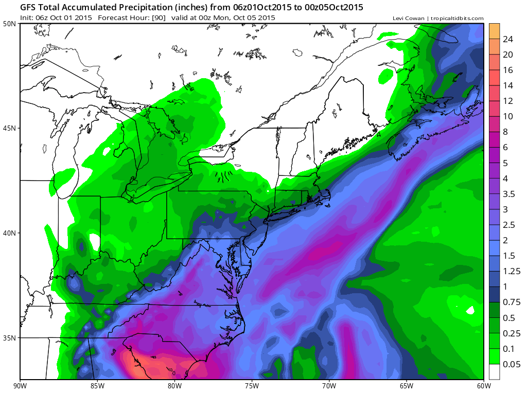
When all is said and done, rainfall totals of near 2″ are likely across the state. As a result, a Flood Watches has been issued for all of central, eastern and southern Maryland.
Hurricane Joaquin
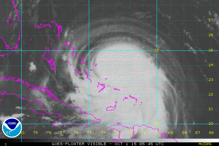
The storm is near the Bahamas and moving west southwestward at 5 mph. The storm is expected intensify a bit more and turn to the north over the next day or so and begin to accelerate as it does.
Yesterday, I mentioned that all of the models except for the usually dependable European model had Hurricane Joaquin making landfall along the east coast and that the Euro solution should not be dismissed.
(tropicaltidbits.com)
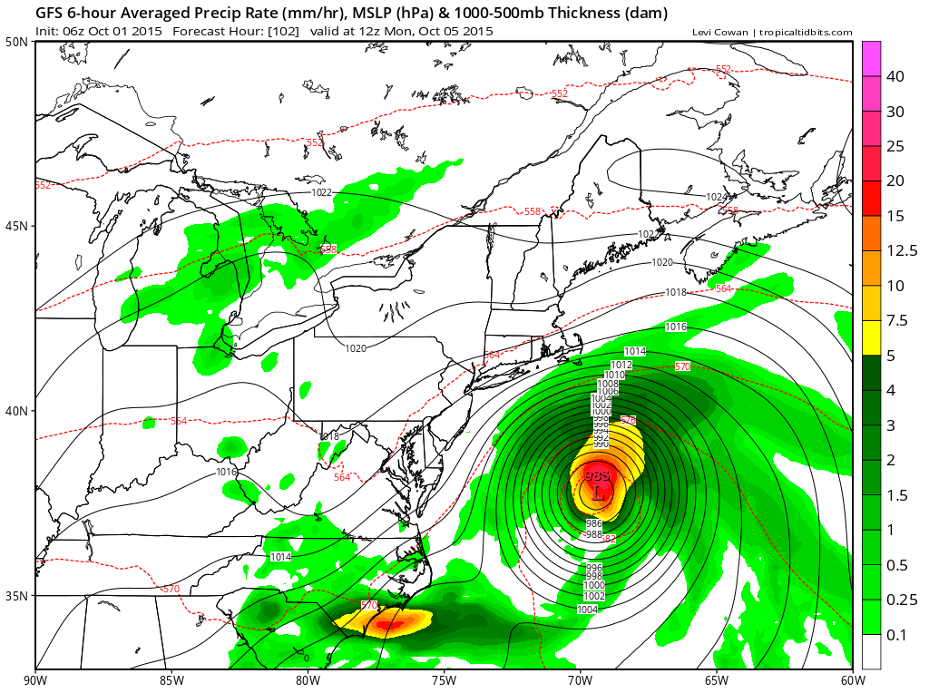
What does this mean? Right now, it appears that the European will end up being correct, keeping Hurricane Joaquin off of the coast and out to sea with very little impact to the eastern seaboard.
Yesterday, the GFS model had Joaquin making landfall in southern North Carolina, while this morning it has shifted the track dramatically eastward, with just a glancing blow to New England.
Right now, it appears that we will dodge the bullet and outside of high surf and minor coastal flooding/erosion, our area will feel very little impact from the storm.
While the forecast and threat from Joaquin is greatly improved from yesterday, things could still change as we move closer to the event.
Stay up to date with storm information on your favorite social media site!
Follow me on Twitter, Facebook and Google+!