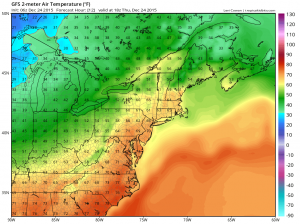
Summary: A cold front is approaching from the west. The front will move through tonight, stalling out just to our south tomorrow and returning back northward this weekend.
Showers will continue today as warm air and moisture continue to stream northward ahead of a cold front to our west.
As the front moves closer winds will increase and thunderstorms will be possible. These storms will be capable of gusty winds and very heavy rainfall. As a result a Flash Flood Watch has been issued for parts of central Maryland.

The front will slide into our area tonight and stall out, keeping shower chances in the forecast through the day tomorrow. It will remain warm, with highs in the upper 60s to around 70.
Showers will be likely on Saturday as the front remains over the area. Highs will be in the low 60s.
Rain chances will decrease on Sunday as the front pushes northward and another cold front approaches from the west. It will be warm, with highs around 70.
The front will push through Sunday evening with a round of showers.
Monday will be much cooler, with highs likely in the mid to upper 40s.
Another storm system will likely affect the area Monday night into Tuesday.
Stay up to date with storm information on your favorite social media site!
Follow me on Twitter, Facebook and Google+!
