
Summary: A cold front will pass through this afternoon and evening. High pressure will build in for the remainder of the work week. Low pressure affect our area by early Saturday morning. Cold high pressure returns behind that system.
A strong cold front will pass through the state this afternoon and evening accompanied with light precipitation. It will be cold enough for the precip to fall as snow in most areas, with a rain/snow mix likely south and east and along the Bay.
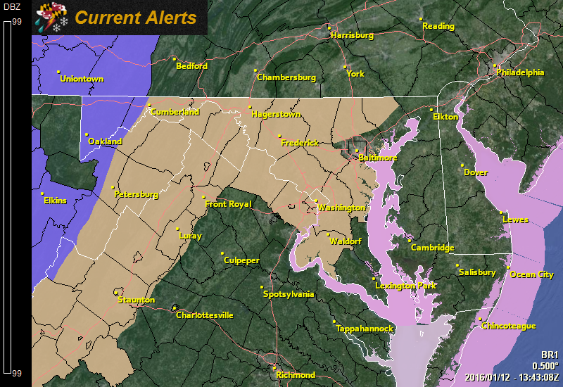
Behind the front, winds will increase. A Wind Advisory has been issued for most of central and western Maryland where winds could gust to near 50 mph. Temperatures will fall into the low 20s tonight.
Tomorrow will be sunny, breezy and cold with highs in the upper 20s to low 30s. Winds will gust to near 25 mph at times.
An upper level disturbance will bring another chance of flurries tomorrow night into Thursday morning. Highs on Thursday will be in the low 40s.
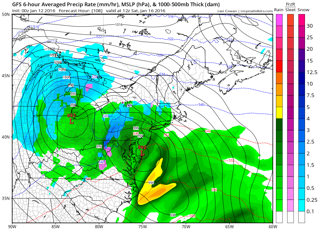
The system will spread rainfall into the area late Friday night into early Saturday morning. The rain will continue through the morning hours on Saturday before tapering off during the afternoon. Highs will be in the mid to upper 40s.
Colder air moves back in on breezy northwest winds on Sunday. A few flurries are possible as well. Highs will be in the upper 30s to low 40s.
Looking ahead to next week, it looks cold with highs generally in the 30s each day.
Stay up to date with storm information on your favorite social media site!
Follow me on Twitter, Facebook and Google+!