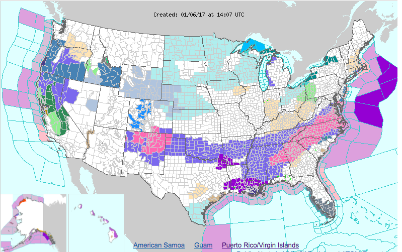
An area of low pressure currently developing over the south will move south of our area tonight and strengthen off of the Carolina coastline before pulling away tomorrow. This system will spread snowfall across the deep south affecting many states as seen in this watch and warning map from the National Weather Service:

While this storm will not greatly impact the majority of our state, accumulating snowfall is likely for some Marylanders, mainly across southern and eastern portions of the state. Generally, areas west of I-95 will see little to no snow accumulation, with amounts increasing as you move south and east. As a result, a Winter Weather Advisory is in effect for Calvert and Charles counties while a Winter Storm Warning is in effect for Dorchester, Somerset, St. Mary’s, Wicomico and Worcester counties.
Timeframe
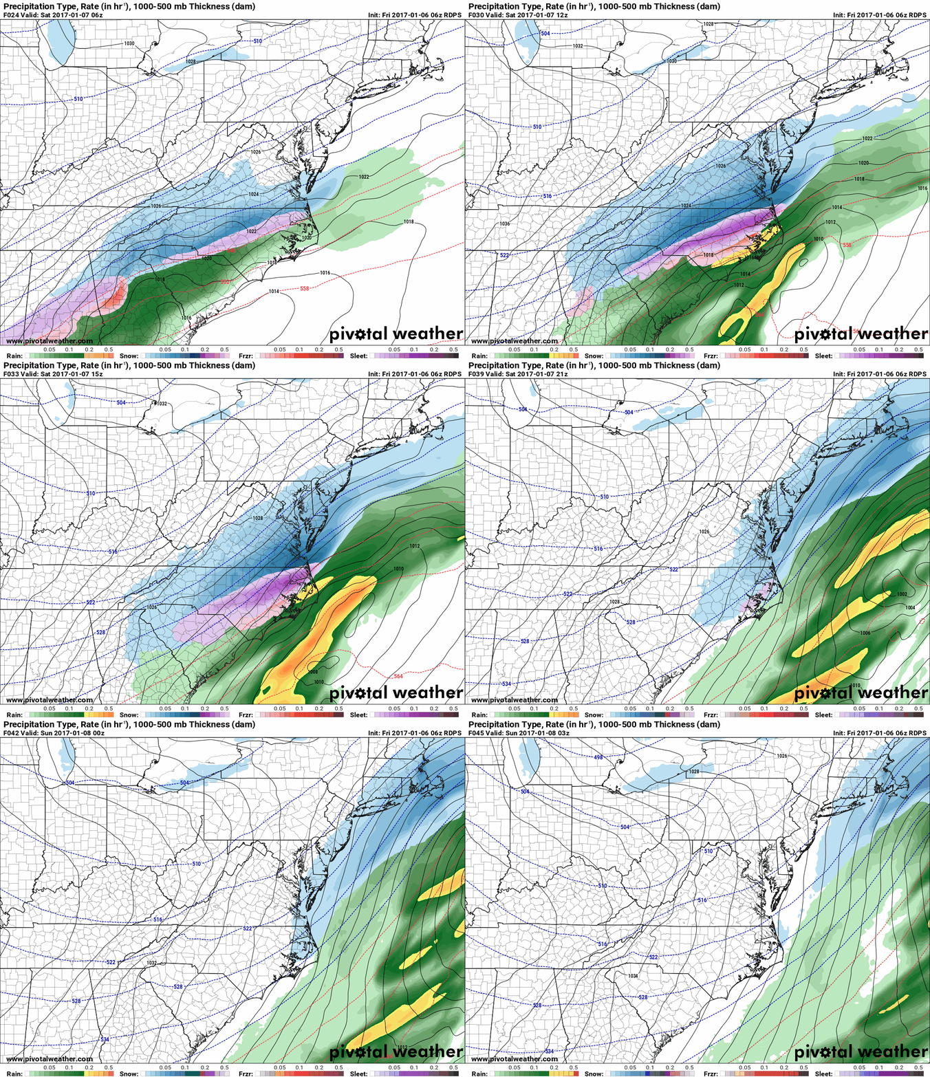
Snowfall move into the southern portions of the state after midnight tonight and spread northward into central Maryland during the early morning hours tomorrow. Snow will continue during the morning hours tomorrow before tapering off west to east during the afternoon and evening hours.
Here is this morning’s Canadian model depicting the timing and extent of the snowfall:

Accumulation
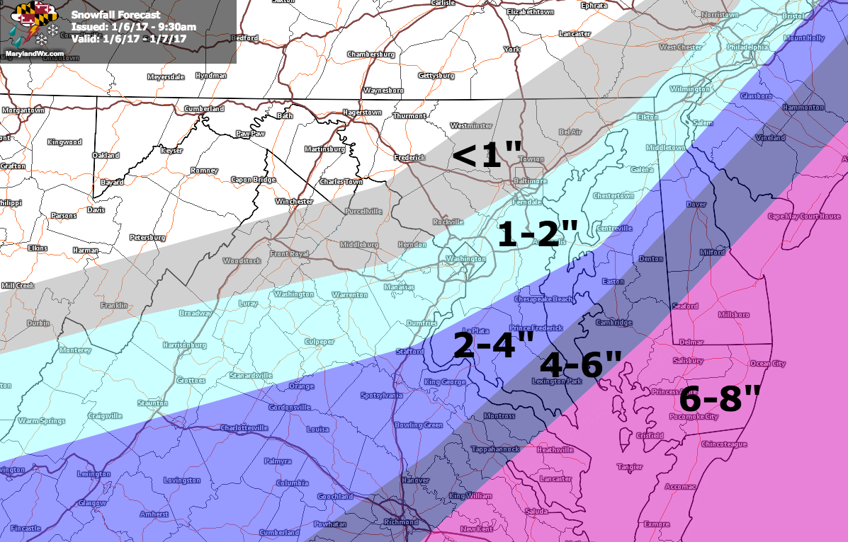
The northern edge of the system will have a sharp gradient and as a result, confidence in the forecast for central Maryland is fairly low. Right now, it appears that accumulating snowfall is likely south and east of I-95, with 1-2″ possible across the Washington/Baltimore metro. Amounts increase as you head south, with 2-4″ likely across most of Southern Maryland, increasing to 6-8″ across the lower Eastern Shore.
Here is my forecast map:
I will post an updated snowfall map later today if needed, and I will also provide intermediate updates on the progress of the storm on Twitter and Facebook.

