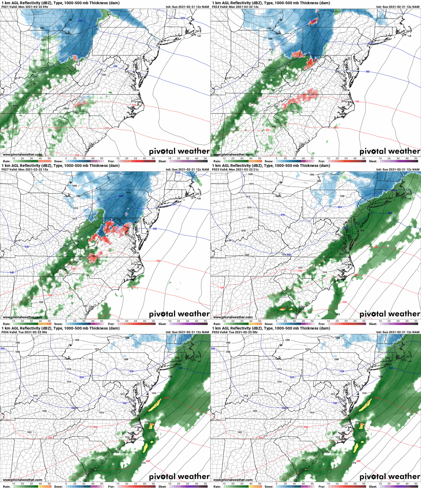
A quick moving area of low pressure is poised to move by to our north during the day tomorrow, bringing another round of precipitation to our state. We will be on the southern side of this system, and with southerly flow and marginal temps, any wintry precipitation should be relatively brief, and light. Nonetheless, due to the timing, enough cold air should be in place tomorrow morning to support a period of snowfall before changing over to plain rain.
Here is today’s NAM, showing the likely timing and progression of the system:
Precipitation will move into the area during the morning hours, arriving into central parts of the state during mid-morning. After a brief period of snow, most areas will see a change to rain, with the rain ending during the afternoon hours.
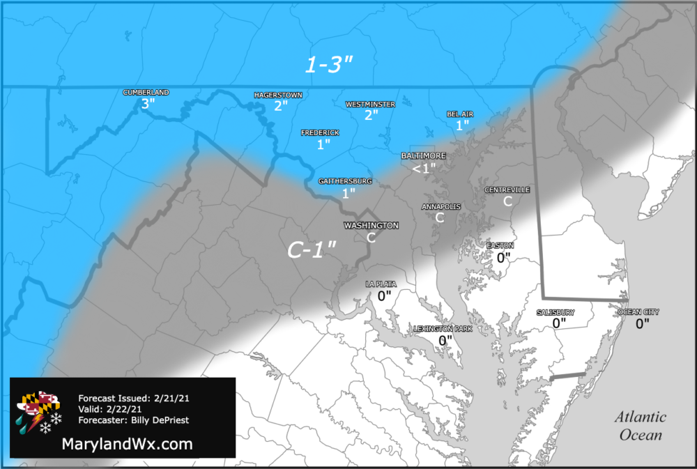
Right now, it appears that accumulation will top out in the 1-3″ range along northern portions of the state. Further south, into central Maryland, up to a coating is possible before the changeover to rain.
Here is my first forecast:
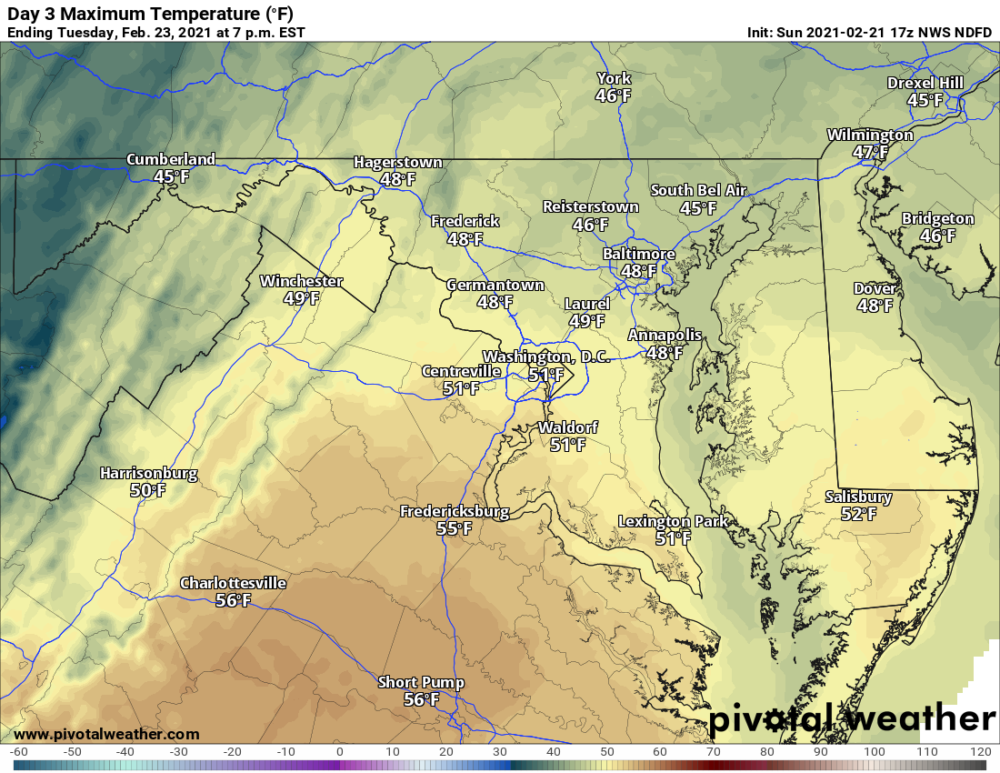
This will be a relatively minor event, and any accumulation will be short-lived as southerly flow pushes temperatures above freezing by the afternoon. Behind the system, temperatures will remain mild, and highs on Tuesday should push into the 40s to around 50 for most areas.


