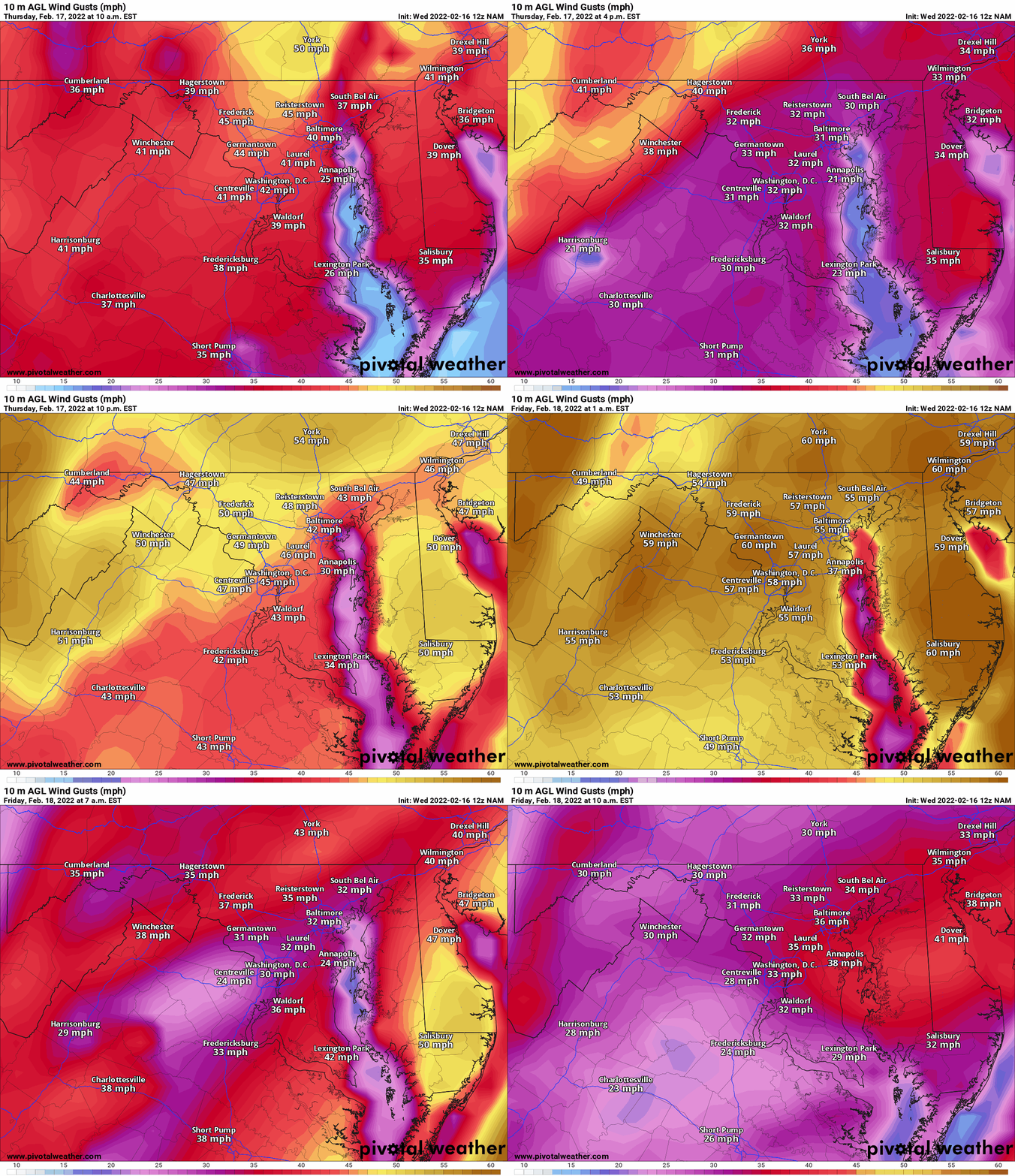
A storm system with a strong cold front to our northwest will strengthen southerly flow today and tomorrow, pushing temperatures upward into the 50s and 60s. Showers are likely as the front approaches our area tomorrow, and winds will increase and become strong tomorrow evening through tomorrow night. Wind gusts to near 50 mph are possible during the overnight as the front passes through. Winds will decrease but still remain gusty during the day Friday.
Here is the NAM 10m wind output for 10AM tomorrow through 10AM Friday, showing the wind increasing and maxing out tomorrow night:

Behind the front, Friday will be much colder, and winds will continue to be blustery with frequent gusts in the 30-40 mph range.


