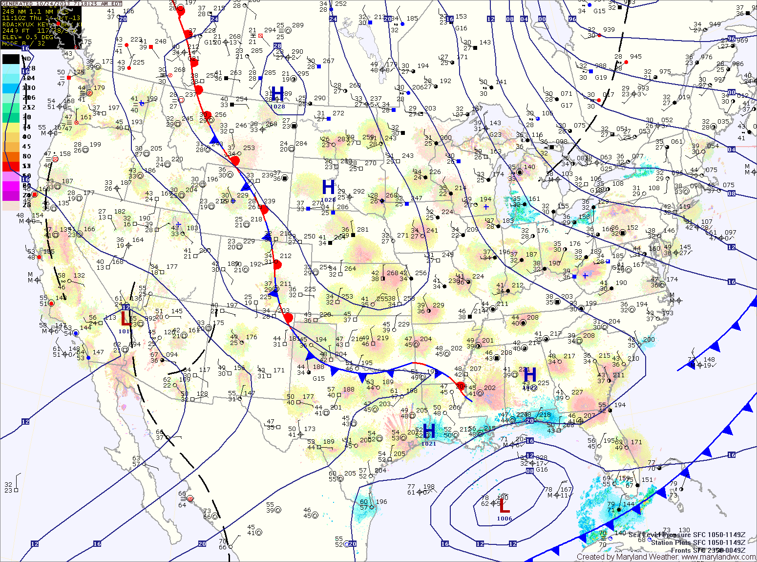
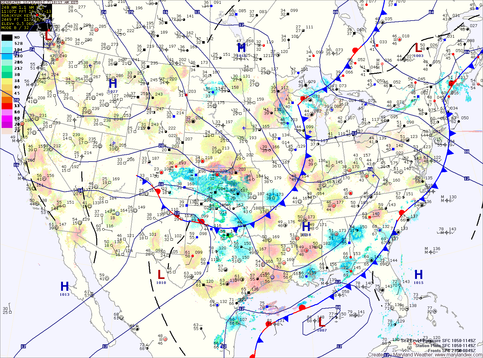
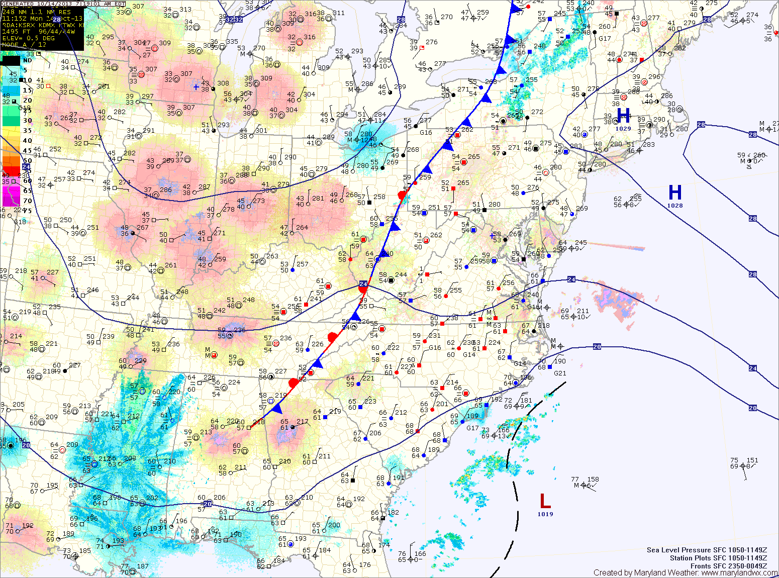
Cool and Dry Stretch into Next Week
Tomorrow will be very similar to today. Mostly sunny, breezy and cool with highs in the low to mid 50s.
Lows tomorrow night will again be near freezing along and east of I-95 and below freezing to the west.

Everything you need to know about the weather in Maryland
Tomorrow will be very similar to today. Mostly sunny, breezy and cool with highs in the low to mid 50s.
Lows tomorrow night will again be near freezing along and east of I-95 and below freezing to the west.
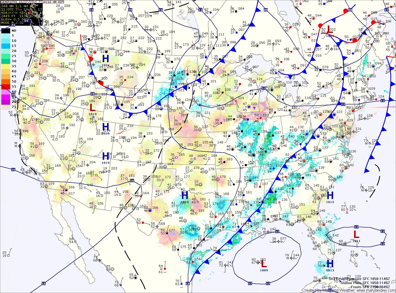
Cooler air will flow into the region tonight and tomorrow. Upslope rain and snow showers are likely in the mountains and lows in the mid 30s are expected across central and eastern portions of the state tonight.
Tomorrow will be mostly sunny with highs in the low to mid 50s.
A reinforcing shot of colder air will move in tomorrow, and highs on Friday will be in the low 50s with overnight lows dropping to near freezing Friday night.
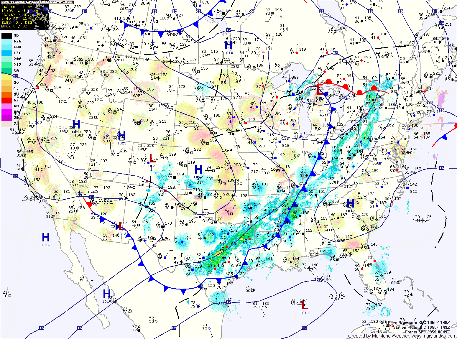
An area of low pressure will form along the front and move towards the area tonight and tomorrow morning. Expect light rain to develop tonight, lasting through the morning hours tomorrow.
Behind the system, breezy northwest winds will bring in colder and drier air. Highs will be in the upper 50s.
Several upper level disturbances will pass through Thursday and Friday, bringing more clouds and reinforcing the colder air. Highs on Thursday will be in the mid 50s while highs on Friday will be held in the low 50s. Friday night could see temperatures drop to near freezing by Saturday morning.
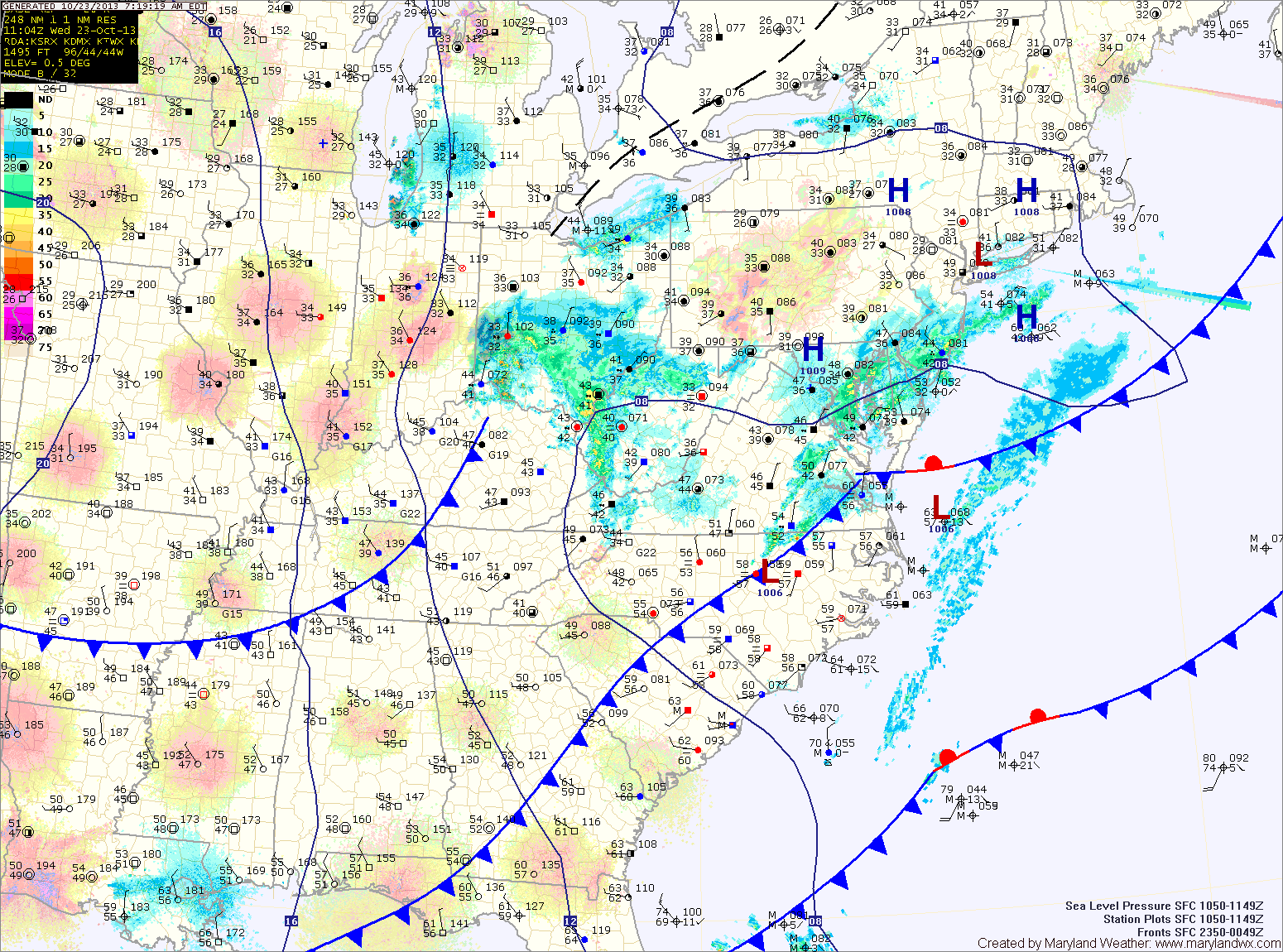
Clouds will increase tomorrow as another cold front approaches from the west. Highs will be in the low to mid 60s.
The front will cross tomorrow night, bringing scattered showers while an area of low pressure develops along it and brings more showers Wednesday morning and into the afternoon.
Highs on Wednesday will be in the mid 50s.
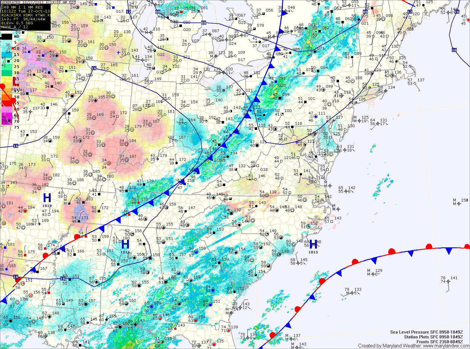
Another cold front will approach tomorrow, bringing an increase in cloud cover during the day. Highs will be in the mid 60s.
The front will pass through tomorrow night, bringing a chance of showers as it does.
Clouds will decrease Sunday and skies will end up mostly sunny. Highs will be in the low 60s.
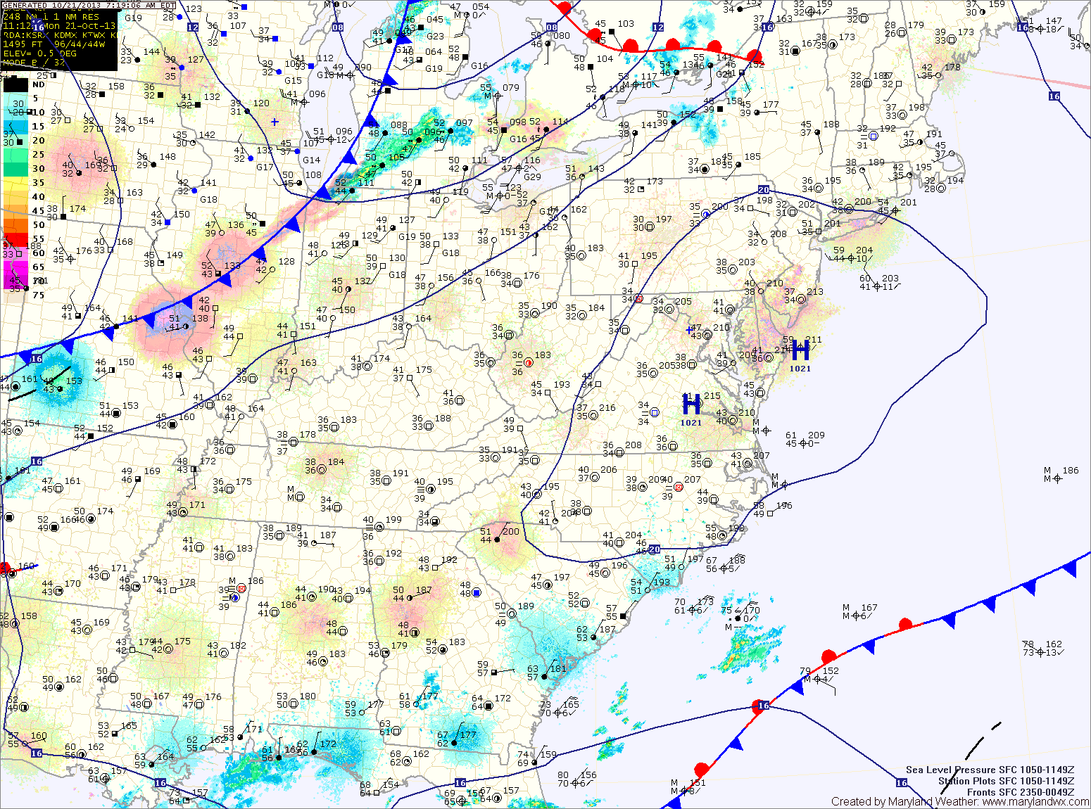
High pressure builds in tomorrow, leading to a sunny and cooler day. Highs will be in the mid to upper 60s.
Saturday will start out partly sunny, but a weak cold front will move through during the evening and will touch off another round of scattered showers during the late afternoon. Highs will be in the upper 60s.
The front will continue to push eastward tonight and will be in the area tomorrow. Scattered showers will break out ahead of the front, affecting the area tomorrow evening. Highs will be in the low 70s.
The front will cross tomorrow night and cooler and drier air will move in to the region. Highs on Friday will be in the mid 60s with decreasing clouds.
Clouds will increase tomorrow as a cold front approaches from the west. Highs will be in the low 70s under partly sunny skies.
Thursday should remain mostly dry under partly sunny skies with a chance of showers developing Thursday night as the front passes through. Highs on Thursday will be in the low 70s.
The front will stall out to our south and east and an area of low pressure will form along it. This low will bring a chance of showers Friday. Highs on Friday will be in the mid to upper 60s.
Clouds will decrease tomorrow with highs around 70 under mostly sunny skies.
Clouds will thicken again on Wednesday as a cold front approaches from the west. Highs will be in the low 70s.
The front will pass through Wednesday night bringing a chance of showers as it does.
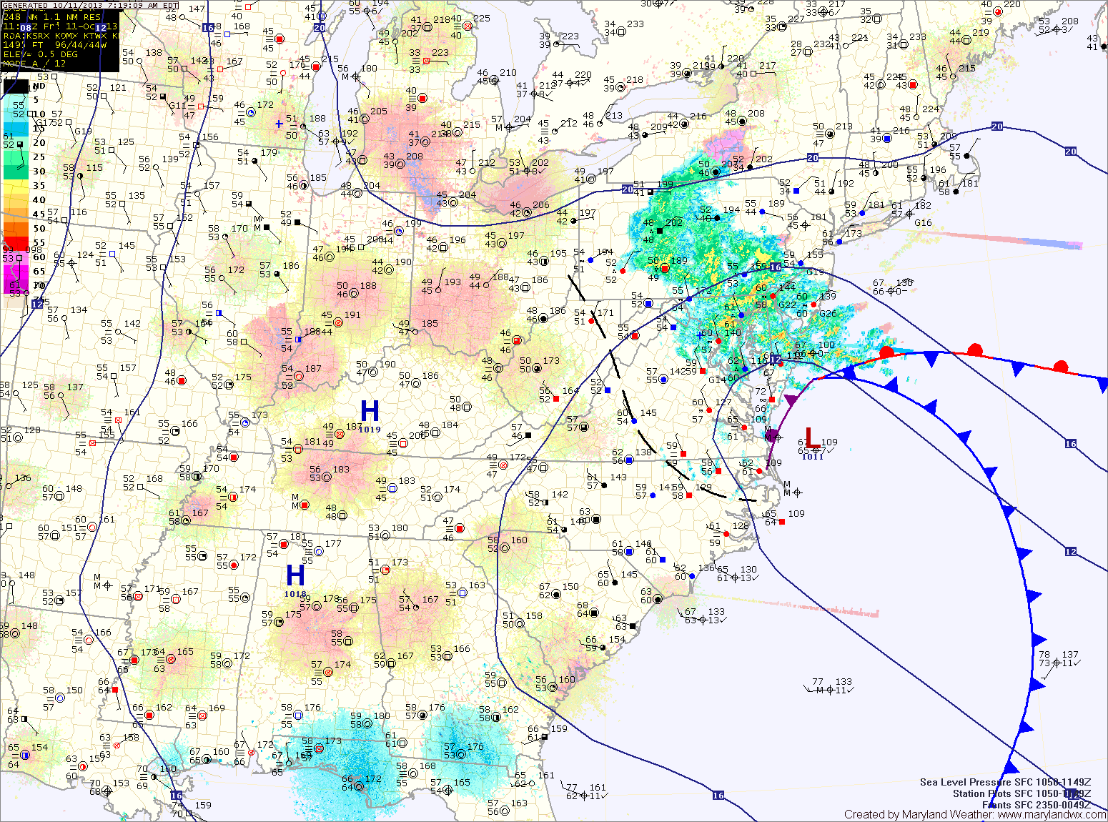
Coastal low pressure remains off the Delmarva coast this morning, continuing to push rainfall into our area. 2-3″ of rain has already fallen across the area, and another 1-2″ is possible today into tonight. Highs today will be in the low 60s.
Periods of rain will continue tonight and into tomorrow morning before tapering to drizzle as the low continues to weaken and slowly move away. Even as the low moves away, the region will remain in northeasterly flow, keeping the clouds and areas of drizzle around through Sunday. Highs both days will be in the low to mid 60s.