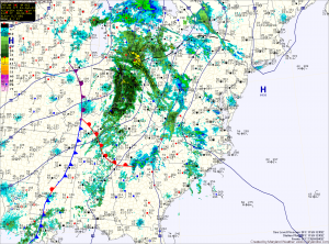
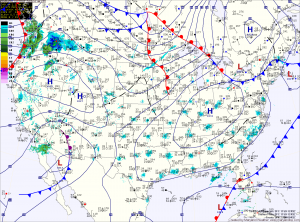
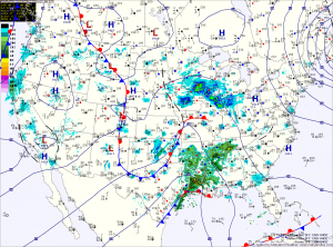
Current Surface MapAn area of low pressure moving through the middle of the country will spread showers into the region today and tonight. Highs today will be in the low 50s.
This weekend will feature a mix of clouds and sun and warmer temperatures. Highs tomorrow will be in the mid 50s, warming to the mid 60s on Sunday.
As we move into next week, a cold front will move towards the region. The front will cross Monday, bringing another round of rainfall.
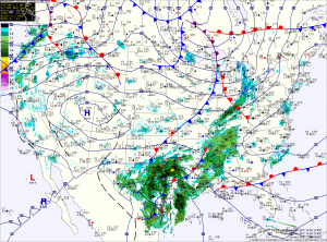
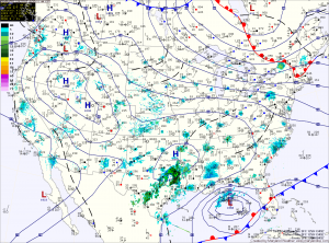
Current Surface MapHigh pressure will build into the region today and tonight. The high will push off the coast tomorrow, setting up southerly flow that will allow temperatures to warm.
Today will be mostly sunny, with highs in the mid 40s.
We will add about 5 degrees or so to that tomorrow, as highs top out in the low 50s under mostly sunny skies.
Wednesday will be even warmer, with highs in the mid to upper 50s.
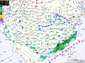
Current Surface MapHigh pressure continues to control our weather today, providing mostly sunny skies with a high around 40 degrees.
The high will continue to influence the area tomorrow, providing a near carbon copy of today. Highs will be around 40.
A weak disturbance will pass by Saturday night, bringing nothing more than a snow shower to far western Maryland and clouds to the rest of the state.
Another system will move by to our northwest on Sunday, dragging a cold front through Sunday night. This front will bring another round of snow showers to far western Maryland, but no precipitation is expected east of the mountains. Highs Sunday will push into the mid 40s.
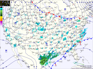
Current Surface MapWith high pressure in control of our weather, we will remain dry into the weekend and aside from a sprinkle or flurry late Saturday night or Sunday, the dry stretch will persist into next week.
Today will be mostly sunny with a high in the upper 30s.
Friday will feature another mostly sunny day with highs in the low 40s.
Temperatures will slowly increase over the weekend, with highs Saturday and Sunday in the low to mid 40s.
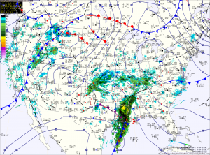
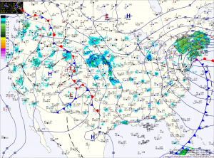
A fast moving area of low pressure will bring light snow to the area tomorrow.
The low is currently over eastern Texas and it will quickly move by to our south during the day tomorrow before it strengthens and moves towards New England.
Expect light snow to develop during the pre-dawn hours tomorrow morning, mixing with or changing to rain in southern Maryland and the lower Eastern Shore.
The rain/snow line will approach the I-95 corridor by tomorrow afternoon and may push into the Baltimore/Washington metro areas.
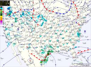
Current Surface MapAs yesterday’s storm pushes northeastward and away from the area, another is taking shape over the Rockies and will move into the area by Saturday morning.
Behind the storm that brought snow, sleet, freezing rain and a lot of plain rain (storm total of 1.31″ here) to the region, skies will gradually clear as northwest winds gust to near 50mph today. A Wind Advisory is in effect until 6pm.
Winds will decrease tonight as weak high pressure builds in tomorrow, providing a calm and tranquil day. Highs will be in the low to mid 40s.
Precipitation will push into the area early Saturday morning. The models are in agreement that the initial precipitation will fall in the form of snow. The models disagree however, on if it will remain snow and how much will fall.