Hot and Humid Today with Afternoon Severe Thunderstorms
A cold front will pass through today, followed by high pressure tomorrow. Several systems will likely affect the area late Thursday and into the weekend. - SEVERE STORMS LIKELY THIS…

Everything you need to know about the weather in Maryland
A HEAT ADVISORY is in effect for most of Central Maryland.
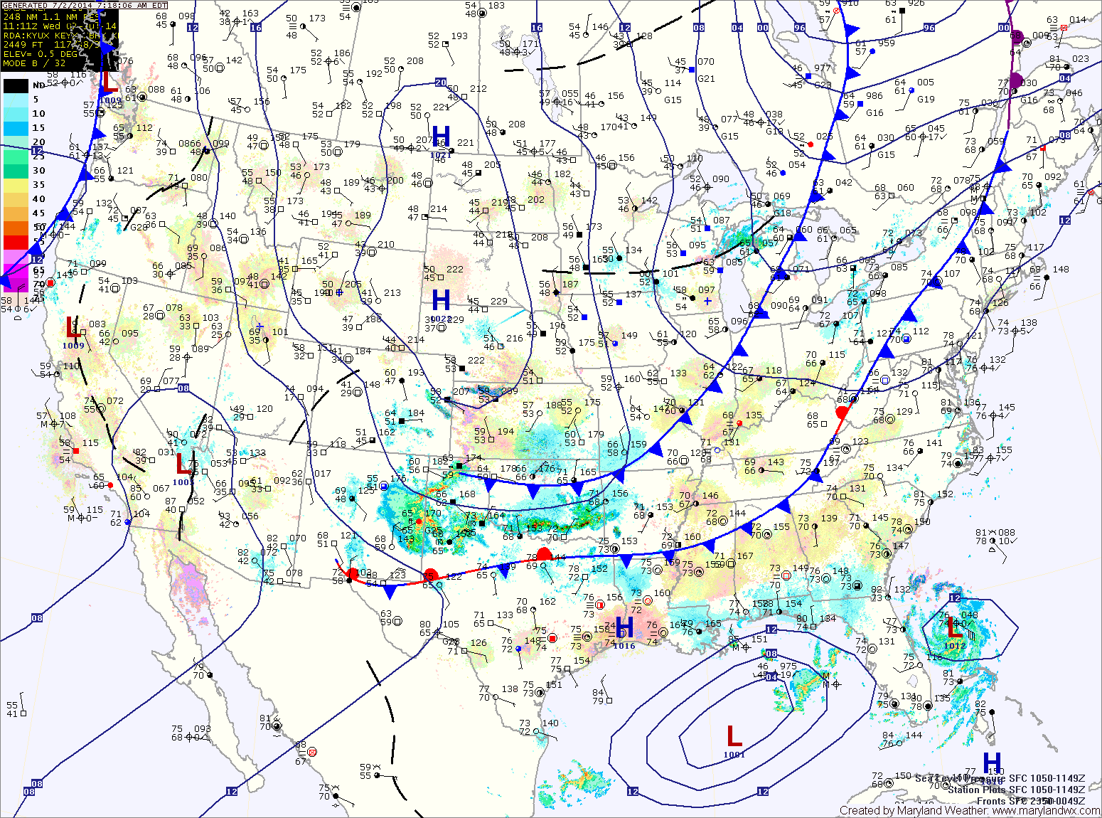
Additionally, the heat and humidity will fuel development of late afternoon and evening thunderstorms. Some of these storms will become severe with damaging winds and large hail as the main threat. Any storm will also be capable of producing very heavy rainfall, leading to localized flash flooding.
Thunderstorms chances will continue tonight and activity will increase again tomorrow afternoon as a cold front approaches from the west. Just like today, these storms will be capable of producing very heavy rainfall, damaging winds and large hail. Highs tomorrow will be in the upper 80s.
Afternoon thunderstorms will likely develop over the mountains and move eastward towards the Baltimore/Washington metro during the late afternoon hours. This activity is expected to be isolated but areas that do see storms could see brief heavy rainfall and gusty winds.
Tomorrow will be similar to today, possibly a few degrees cooler with a slight chance of afternoon storms. Highs will be in the mid 90s with dewpoints in the low to mid 70s and heat indices near 105.
…HEAT ADVISORY REMAINS IN EFFECT FROM 11 AM THIS MORNING TO 9 PM EDT THIS EVENING…

The cold front will slowly move southward, continuing rain chances tonight and tomorrow but more importantly it will drop temperatures about 10 degrees. Highs tomorrow will be around 90. Additionally, showers and thunderstorms are likely again tomorrow as the front remains in the area.
…HEAT ADVISORY REMAINS IN EFFECT FROM 11 AM THIS MORNING TO 9 PM EDT THIS EVENING…
…EXCESSIVE HEAT WATCH IN EFFECT FROM SATURDAY MORNING THROUGH SATURDAY EVENING…

An Excessive Heat Watch is in effect for tomorrow. Highs around 100 will combine with the humidity to push the heat index to near 110 degrees. Scattered afternoon showers and thunderstorms are also possible.
…HEAT ADVISORY REMAINS IN EFFECT UNTIL 10 PM EDT THIS EVENING…

There is a slight chance of showers and thunderstorms this afternoon in the higher terrain and that activity will weaken and move east, bringing a slight chance of rain into central Maryland overnight.
Tomorrow will still be warm, with temperatures in the mid 90s and thunderstorms likely in the afternoon. Some of the storms could be severe, with gusty winds and large hail.
…HEAT ADVISORY NOW IN EFFECT FROM NOON TODAY TO 10 PM EDT THURSDAY…

Summer begins at 7:09pm this evening and the weather will be appropriate. High pressure centered over the southeast will pump hot and humid air into the region, sending high temperatures into the mid to upper 90s today. The heat combined with the humidity will push heat index values above 100 degrees this afternoon.
The will not be much relief tonight, as temperatures will only fall to the mid 70s (around 80 in the cities) and heat index values will remain in the 80s to near 90.
Tomorrow is looking like it will be the hottest day, with highs approaching 100 degrees in most areas. Heat index values will again be around 105 degrees.