Rain develops today, lasts into tomorrow
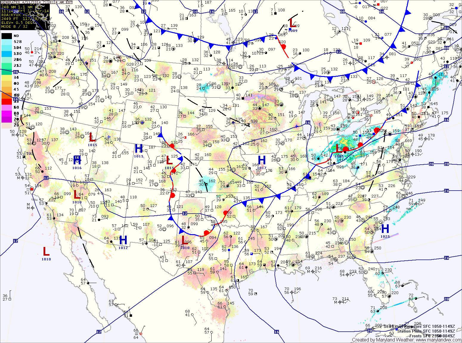
A stationary front that is currently draped just to our south will provide a path for an area of low pressure to ride along. The low will spread rain into…

Everything you need to know about the weather in Maryland
A FLOOD WARNING is in effect for portions of Anne Arundel, Baltimore, Howard, Montgomery, and Prince George’s counties.
A COASTAL FLOOD WARNING is in effect for Anne Arundel, Baltimore, Calvert, Prince George’s and St. Mary’s counties.
A COASTAL FLOOD ADVISORY is in effect for Caroline, Dorchester, Queen Annes, Somerset, Talbot and Wicomico counties.
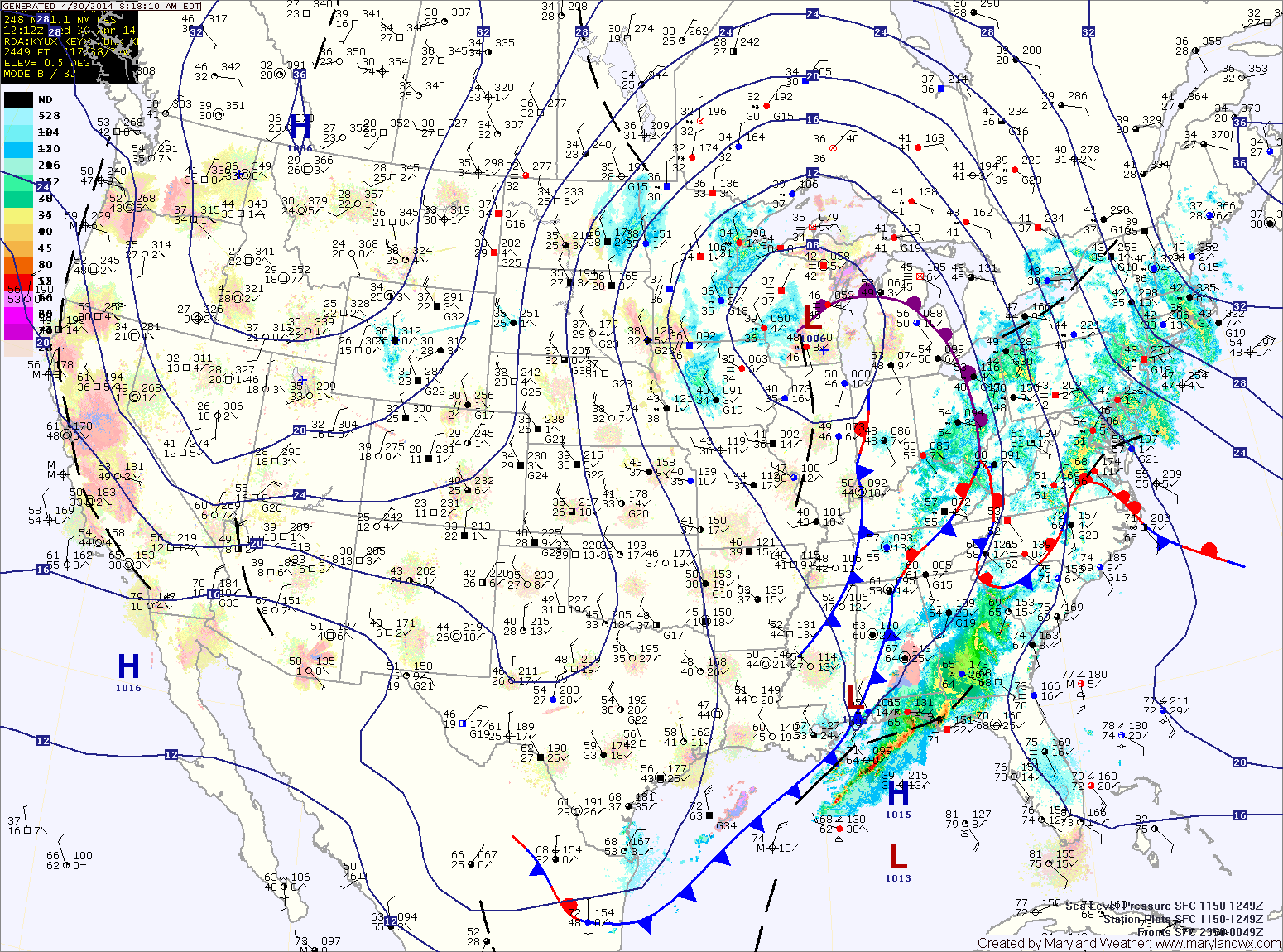
As the area of low pressure that has been slowly moving through the center of the country continues its slow journey northeastward, expect more rainfall and thunderstorms across the area today. The rain will be heavy at times as moisture from the Gulf of Mexico and the Atlantic enhance the rainfall.
The rain will continue through tonight. Thunderstorms will also be possible tonight, especially across southern Maryland. Expect a total 1-2″ of rain today and an additional 1-2″ tonight. Highs today will be in the mid 60s.
A cold front will cross the area tomorrow morning, slowly bringing an end to the rain. Expect partial clearing during the afternoon and highs in the low 70s.
Today will feature increasing clouds with the first round of showers moving in late this afternoon or evening. Highs will be in the low to mid 60s.
Showers will continue tonight and tomorrow, with the rainfall becoming steadier tomorrow afternoon. It will also be breezy, with highs in the low to mid 50s.
Rain will continue tomorrow night and Wednesday, heavy at times. Isolated thunderstorms are also possible Wednesday afternoon. Highs on Wednesday will be in the mid to upper 60s.
The front will clear the state tonight and skies will partially clear heading into tomorrow morning. Another front will sag southward tomorrow with very little moisture. There is a slight chance of an afternoon or evening shower, but otherwise it will be dry and warm with highs in in the low 70s.
Sunday will be mostly sunny with highs in the mid 60s.
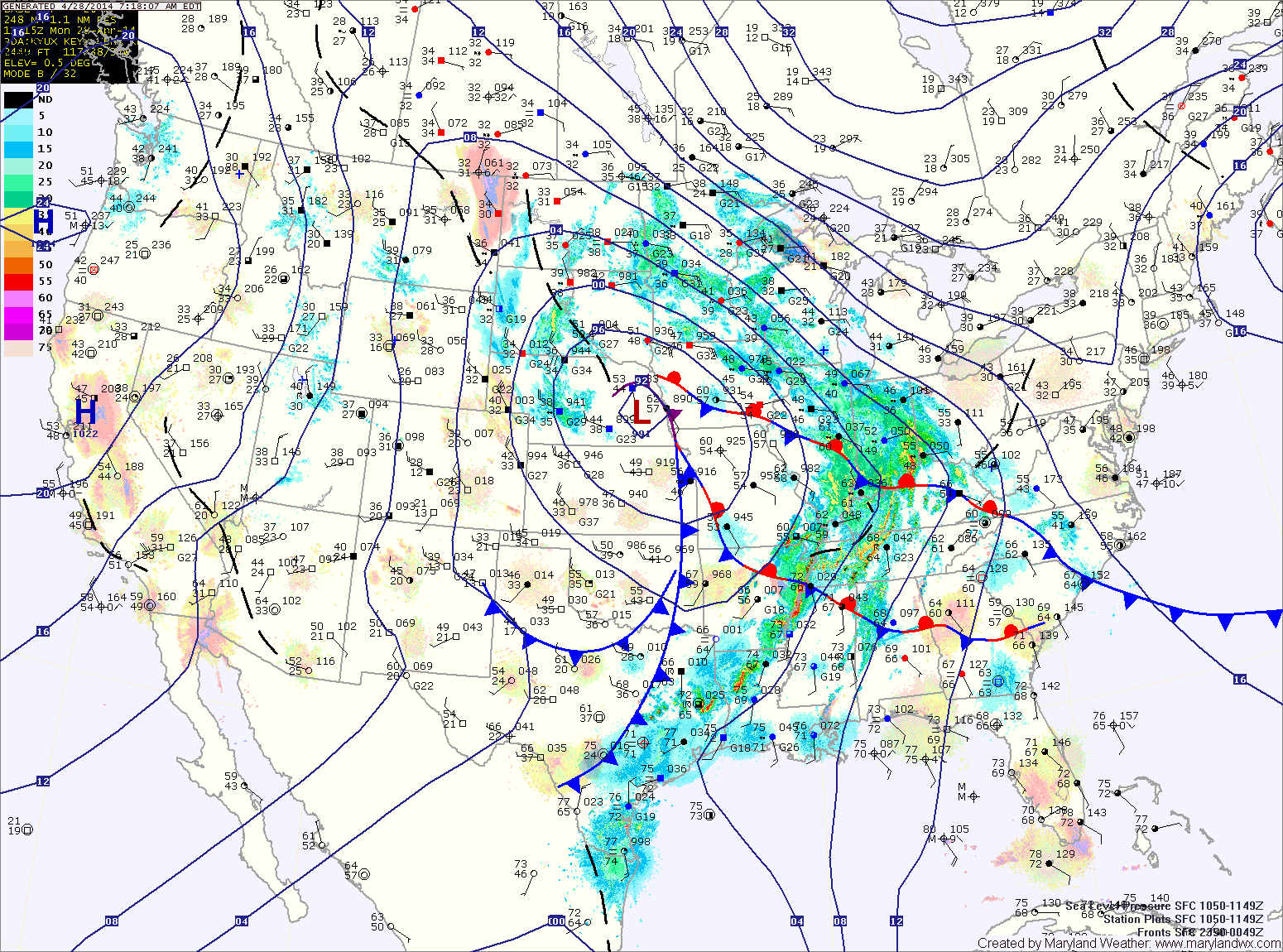
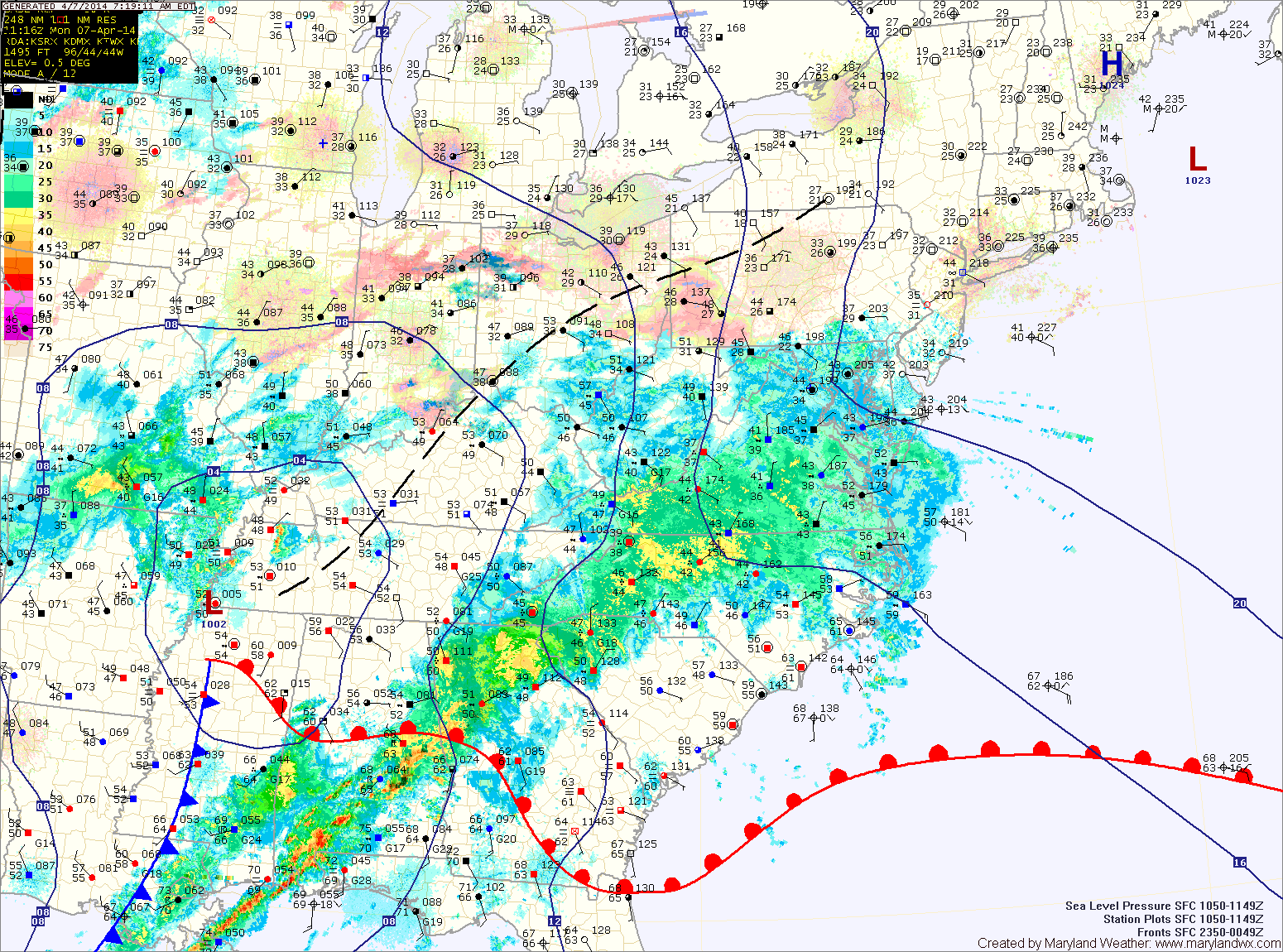
A strong cold front is moving through, spreading showers and thunderstorms into the area. The showers and storms will continue into this evening before tapering off after dark. As colder air moves in behind the front, the rain may end as a brief period of snow, mainly north and west of the cities. Highs today will reach the mid to upper 60s before falling this afternoon.
Rain will overspread the area this evening and last through the night. The front will clear the area tomorrow morning as high pressure builds back in.
Tomorrow will be mostly sunny with highs around 70.
Sunday will feature a few more clouds than Saturday but will also be warmer. Highs will push into the mid to upper 70s.
After some early morning showers, skies will gradually clear through the day tomorrow as afternoon highs reach the low 60s.
Wednesday and Thursday will be mostly sunny with highs in the low 60s.
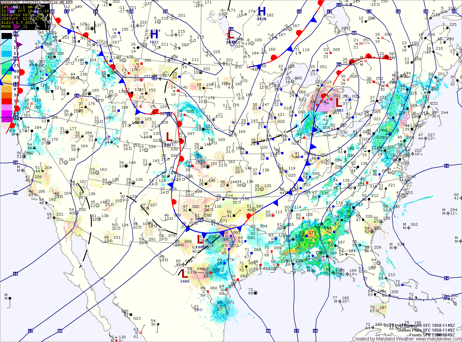
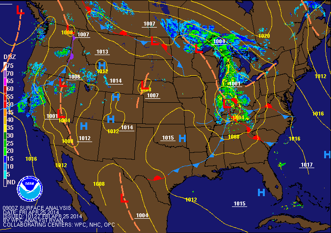
As the front moves overhead tonight, it will likely stall out. At the same time, another area of low pressure will develop to along the front and spread another round of rainfall into the area this weekend.
Expect periods of rain tomorrow. The rain could be heavy at times, especially tomorrow afternoon and into tomorrow night. Highs will be in the low 50s.