Sandy to Make Landfall This Evening
11:00am Update – Hurricane Sandy Strengthens Again
Sandy Now Heading Towards the Coast
Continuing Sandy Coverage – 10:30pm update
Hurricane Sandy Updates – 8:00pm Update
This blog post will be updated throughout the day today and tomorrow as needed with updates on the forecast of Hurricane Sandy.
Please check this post periodically for updates. I will also update Facebook with any new information.
———————————————————————
8:00pm Update:
Current Advisories:
-Flood Watch for the entire state
-Coastal Flood Advisory for Western shore of Bay
-Coastal Flood Watch for counties along the Potomac
-Coastal Flood Warning for the Atlantic Beaches
-High Wind Watch for entire state
The Latest Stats (8:00pm):
Maximum Sustained Winds: 75mph – Category 1 Hurricane
Minimum Pressure: 961mb (28.38″)
Moving NE @ 13mph
Tropical Storm force winds extend 520 miles from the center.
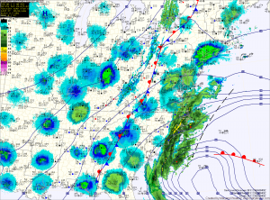
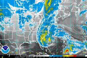
No changes in strength or motion of Sandy with this update, although satellite imagery appears to show increase in convection near the center of the storm which would indicate a strengthening cyclone.
Previous updates follow below…
———————————————————————
6:00pm Update:
Current Advisories:
-Flood Watch for the entire state
-Coastal Flood Advisory for Western shore of Bay
-Coastal Flood Watch for counties along the Potomac
-Coastal Flood Warning for the Atlantic Beaches
-High Wind Watch for entire state
The Latest Stats (5:00pm):
Maximum Sustained Winds: 75mph – Category 1 Hurricane
Minimum Pressure: 961mb (28.38″)
Moving NE @ 13mph
Tropical Storm force winds extend 520 miles from the center.
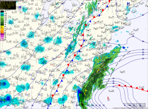
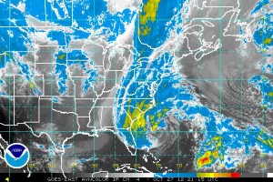
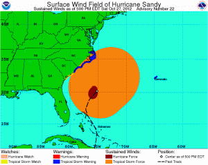
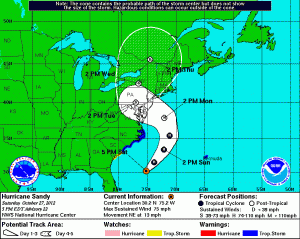
Current forecast remains on track. Expect rain to develop late tonight, becoming steadier tomorrow and heavier through the day tomorrow. Total rainfall of 5-10″ likely. Winds will gradually increase through the day tomorrow into tomorrow night when the strongest winds will begin.
From the High Wind Watch:
* TIMING…SUNDAY NIGHT AFTER MIDNIGHT THROUGH TUESDAY EVENING.
THE STRONGEST WINDS WILL LIKELY OCCUR BETWEEN DAYBREAK MONDAY AND
DAYBREAK TUESDAY.
* WINDS…SUSTAINED NORTH WINDS 35 TO 45 MPH WITH GUSTS TO 60 MPH
LATE SUNDAY NIGHT THROUGH MIDNIGHT TUESDAY. WINDS WILL THEN
BECOME NORTHWEST AT 30 TO 40 MPH WITH GUSTS TO 60 MPH TUESDAY.
FINALLY…WINDS WILL BECOME SOUTHWEST 25 TO 35 MPH WITH GUSTS TO
50 MPH TUESDAY MORNING BEFORE DIMINISHING TUESDAY AFTERNOON.
* IMPACTS…A PROLONGED 24-TO-36 HOUR HIGH WIND EVENT WILL LIKELY
TAKE PLACE ACROSS THE WATCH AREA. COUPLED WITH HEAVY RAINS FROM
SANDY…THE HIGH WINDS WILL LEAD TO SIGNIFICANT TREE DAMAGE
ACROSS THE WATCH AREA. RESIDENTS…VISITORS… AND BUSINESSES
ACROSS THE REGION SHOULD PLAN FOR WIDESPREAD POWER AND
COMMUNICATION OUTAGES.
The next update from the National Hurricane Center will be at 8:00pm.
Previous updates follow below…
———————————————————————
4:00pm Update:
Current Advisories:
-Flood Watch for the entire state except Garrett, Washington and Allegany Counties
The Latest Stats (2:00pm):
Maximum Sustained Winds: 75mph – Category 1 Hurricane
Minimum Pressure: 961mb (28.38″)
Moving NNE @ 11mph
Tropical Storm force winds extend 450 miles from the center.
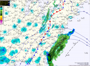
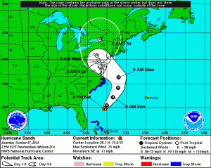
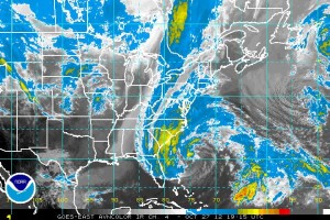
No major changes to the intensity or forecast track of Sandy with this update. Previous forecast remains on track
The next update from the National Hurricane Center will be at 5pm. I will update this post after that time.
Previous updates follow below…
———————————————————————
11:00am Update:
Current Advisories:
-Flood Watch for the entire state except Garrett, Washington and Allegany Counties
The Latest Stats (11:00am):
Maximum Sustained Winds: 75mph – Category 1 Hurricane
Minimum Pressure: 958mb (28.29″)
Moving NNE @ 9mph
Tropical Storm force winds extend 450 miles from the center.
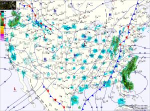
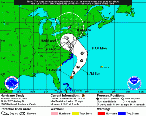
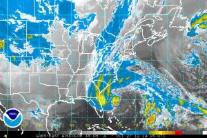
No major changes to the intensity or forecast track of Sandy with this update.
The next update from the National Hurricane Center will be at 2pm. I will update this post after that time.
Previous update follows below…
———————————————————————
8:00am Update:
Current Advisories:
-Flood Watch for the entire state except Garrett, Washington and Allegany Counties
The Latest Stats (8:00am):
Maximum Sustained Winds: 75mph – Category 1 Hurricane
Minimum Pressure: 960mb (28.35″)
Moving NNE @ 10mph
Tropical Storm force winds extend 450 miles from the center.
Sandy is expected to continue to move to the NE today and tomorrow before turning back towards the NW tomorrow night into Monday.
Sandy Taking Aim on the Delmarva
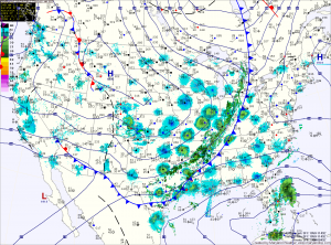
Hurricane Sandy continues to be the focus of attention as we head into the weekend. Consensus is building that the storm will combine with the cold front to our west to have a significant impact on our area.
*The Setup*
The high pressure to our northeast will block and even steer Sandy towards the coast early next week. Meanwhile, Sandy continues to slow and grow in size. This is important to remember when looking at the path outlined by the National Hurricane Center. Sandy will likely be a very large in size and will bring significant impacts to a very large portion of the east coast regardless of the exact path.
Sandy is currently over the northern Bahamas and moving northwestward. Maximum sustained winds are now 80mph. This general motion and strength are expected to continue today before Sandy makes a gradual turn back towards the northeast tomorrow. This is due to the front to our west that will eventually absorb the system. 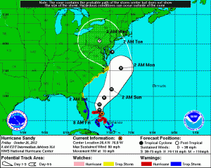
All Eyes Toward the Weekend
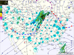
The clouds due to moisture off the Atlantic will persist into the afternoon, keeping high temperatures in the low 70s.
Expect drizzle to develop tonight into tomorrow morning as easterly flow continues. There should be some partial clearing tomorrow afternoon with highs in the low 70s.
As Hurricane Sandy continues its northward trek, it will combine with the high to the north to maintain and enhance the easterly flow in our area. This will lead to a cloudy Saturday with highs in the mid to upper 60s.
Partly Sunny Today; Still Watching Sandy
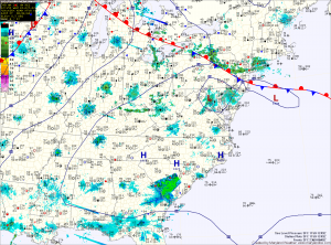
High pressure off the New England coast will set up an easterly flow tomorrow. This will bring in more clouds and a chance of drizzle as we move towards tomorrow night. Highs tomorrow will be held down by the increase in clouds, topping out in the low 70s. Areas west of I-95 may push into the mid to upper 70s under more sunshine.
Friday looks like to be similar to Thursday. Partly sunny skies and highs in the low to mid 70s.
Dry into the Weekend; Sandy Forms in the Caribbean
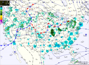
Highs today and tomorrow will be in the upper 70s to around 80 degrees under partly sunny skies.
Thursday through Saturday will feature more clouds. The clouds will hold temperatures down a bit, keeping highs in the low to mid 70s.
