Current Surface MapA storm system moving through the Great Lakes region will push a cold front through the area tonight. Ahead of the front, scattered showers are likely and a thunderstorm can’t be ruled out. The best chance for rain will be late this afternoon and evening. Highs will be in the upper 50s to low 60s.
The front will clear the area tonight allowing drier air to move in for the weekend. Tomorrow will be mostly sunny but breezy with highs in the low 60s.
Sunday will also be mostly sunny with less wind. Highs will be around 60.
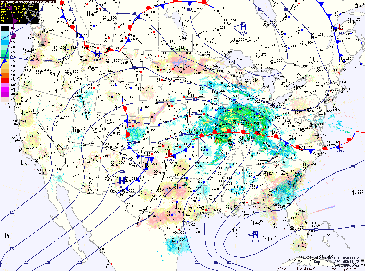
Current Surface MapA stalled out front just to our south will provide a path for several disturbances to move through the region. Expect cloudy skies today with isolated showers. Highs will be around 60.
One disturbance will move through this evening and tonight bringing a round of rainfall. Another system will form and move by to the northwest tomorrow, dragging a cold front through the area tomorrow evening. Expect more showers tomorrow into tomorrow night. Highs will be in the upper 50s to low 60s.
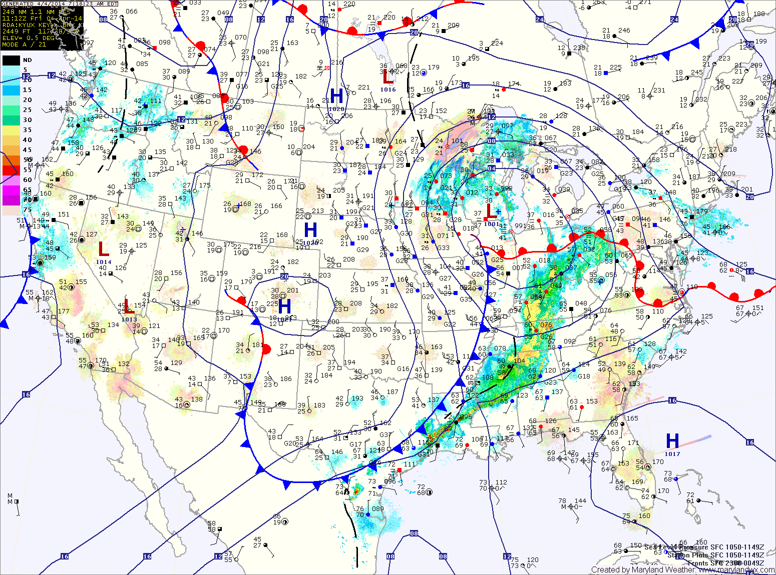
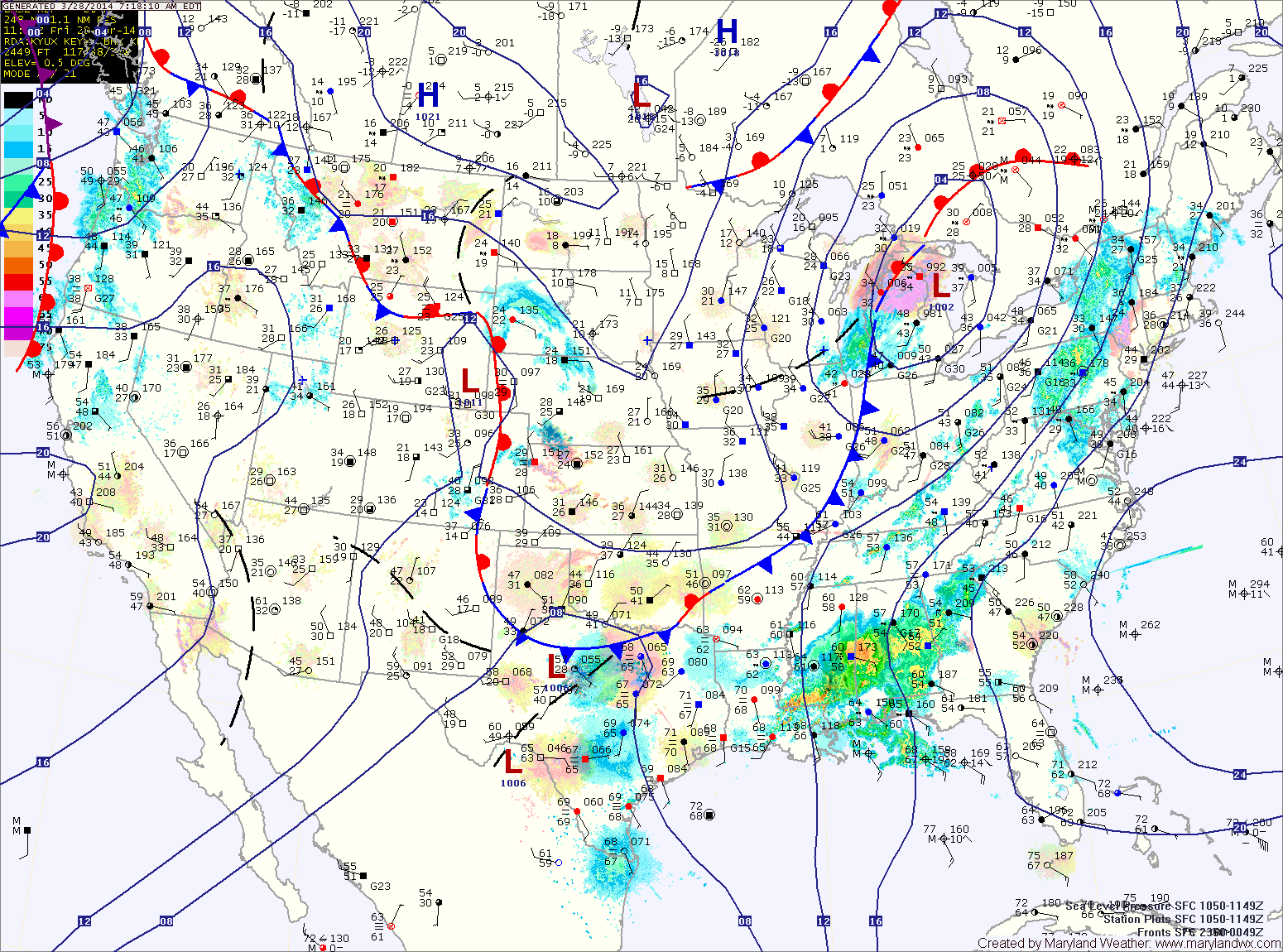
Current Surface MapA cold front is moving into the area this morning while a batch of showers moves west to east along and north of the Mason-Dixon line. The front will stall out across the state today and become the focus for several areas of low pressure to bring showers to the area tomorrow and Friday.
Today will be cloudy with perhaps a few breaks of sun this afternoon. The showers moving through Pennsylvania should remain north of the state but an isolated shower along the far northern counties can’t be ruled out. Highs today will be in the low to mid 60s.
Isolated showers will move through tonight and tomorrow. Highs tomorrow will be in the upper 50s to around 60.
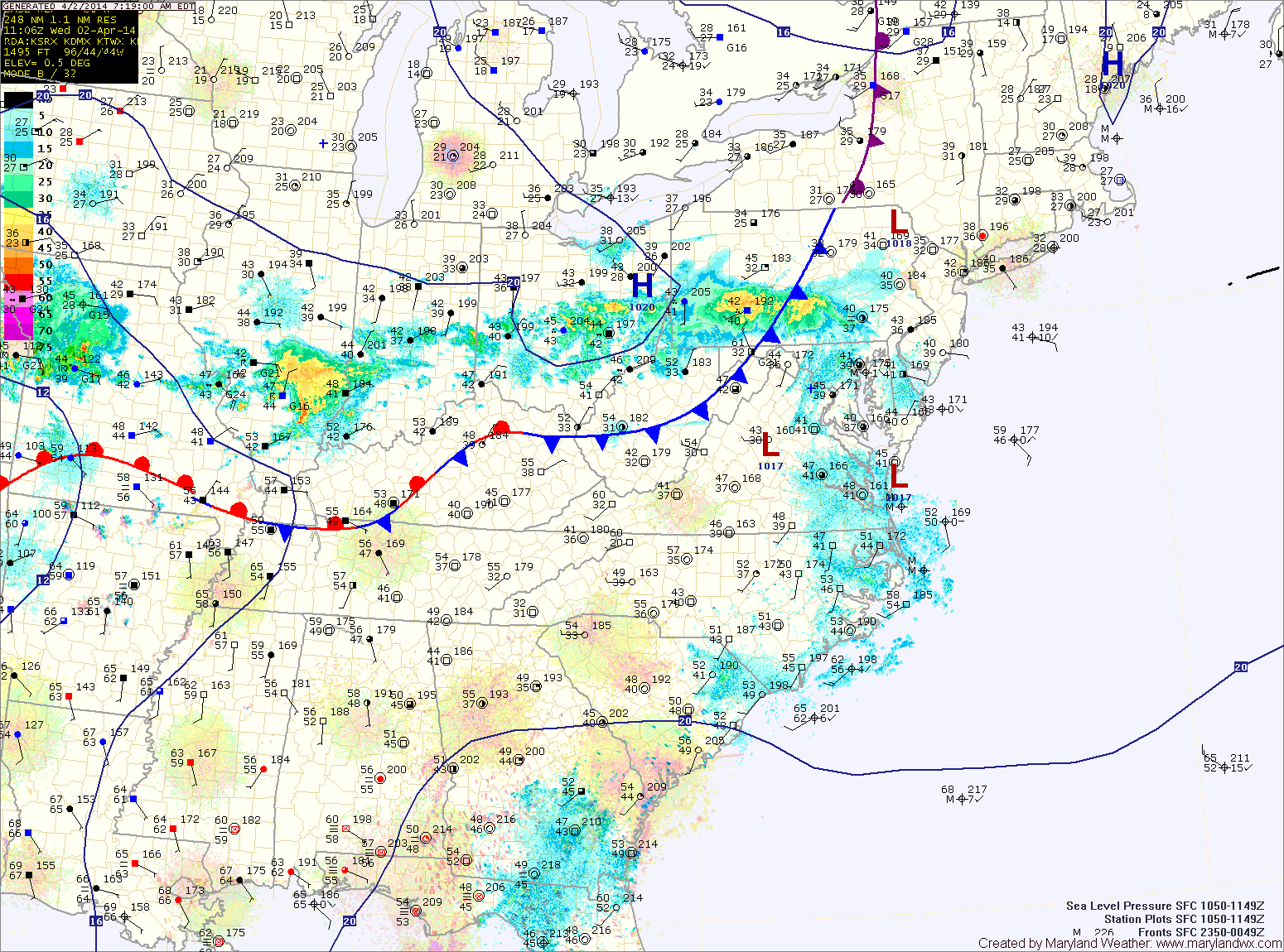
Current Surface MapA cold front will approach from the west today, spreading high clouds into the area through the day. Highs will be in the low 60s.
The front will move through tonight and then stall out across the region tomorrow. North of the boundary, highs will be in the mid to upper 60s while areas along and just south of the boundary will see low 70s. There is also a slight chance of showers tomorrow afternoon and into tomorrow night as a weak area of low pressure moves along the front.
Another low will form to the west on Thursday, keeping a slight chance of showers in the forecast during the day. Highs will be in the low 60s.
Current Surface MapAfter a wet, cold and even snowy weekend, the beginning of this week will be pleasant with warmer temperatures and ample sunshine.
This past weekend’s storm brought over 2 inches of rain to the area and has now moved off to the northeast. The storm will still be close enough to cause breezy conditions today but otherwise, expect mostly sunny skies and highs around 60.
Tomorrow will be similar to today except winds will decrease and there will be a bit more cloudiness. Highs will be in the low 60s.
Another system will move towards the area on Wednesday causing clouds to increase. It will continue to be warm, with highs in the mid to upper 60s.
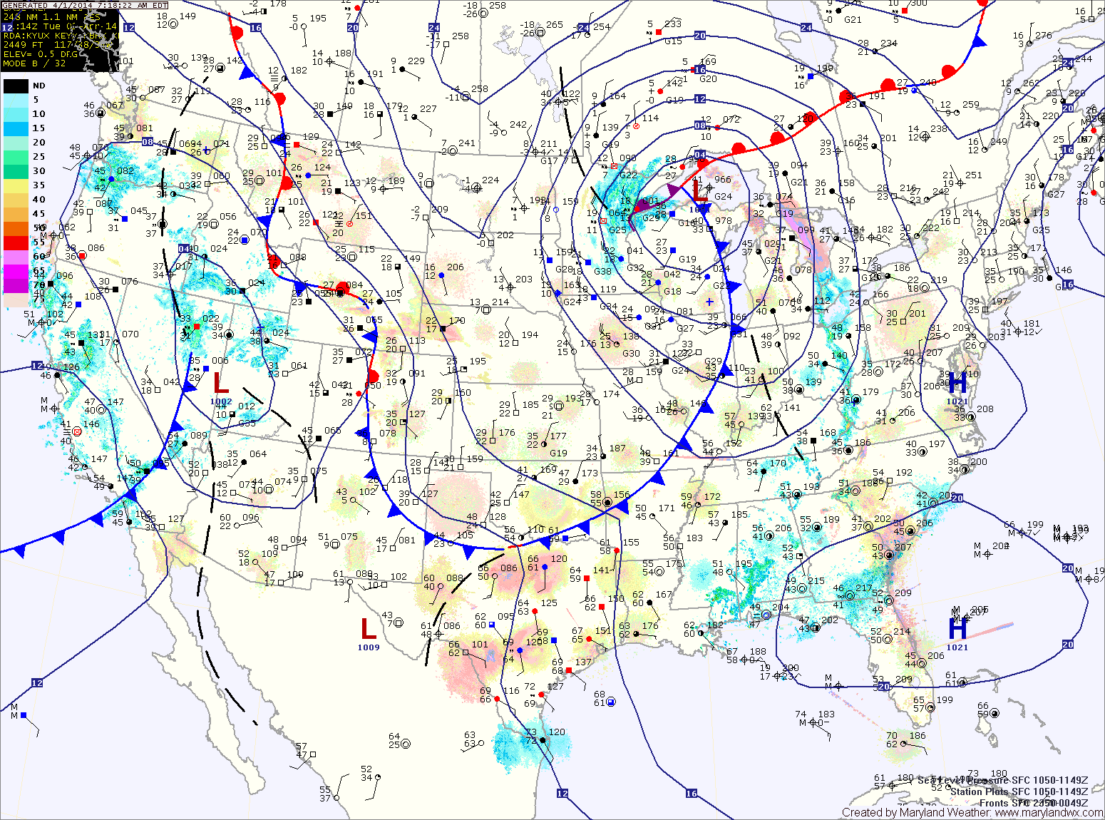
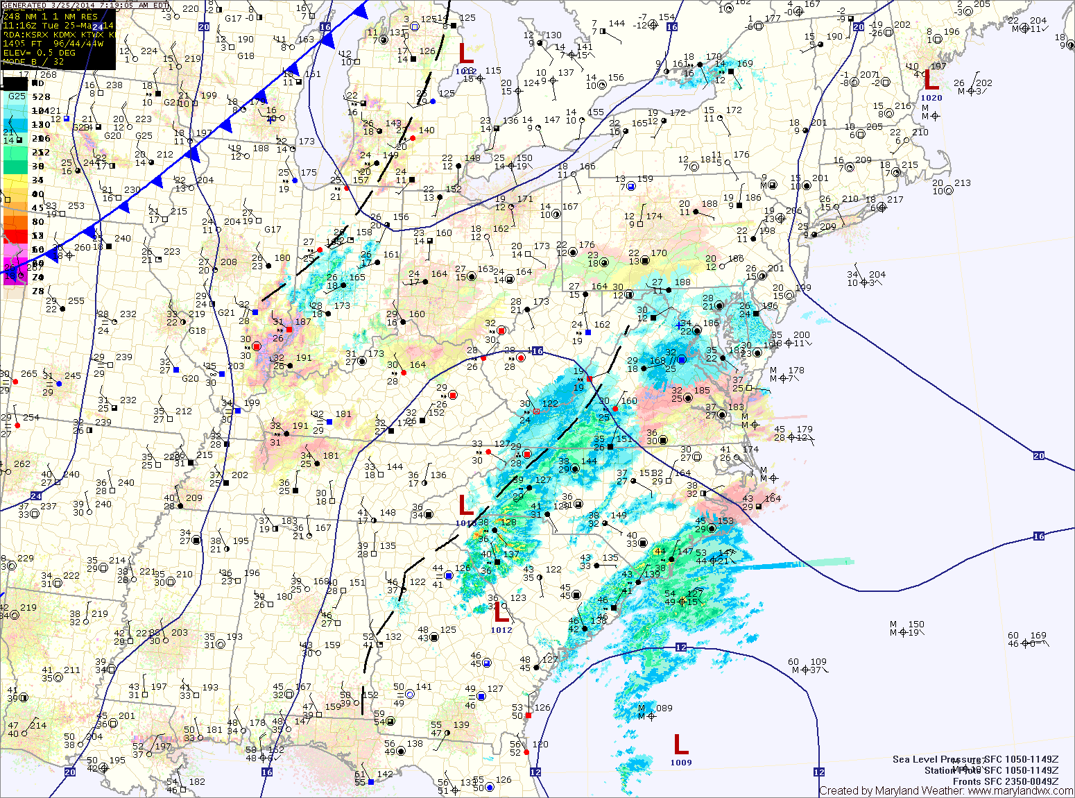
Current Surface MapA cold front to our west is spreading showers into the area this morning. The showers will increase in coverage this afternoon and last into tonight. Highs today will likely reach the upper 50s to lower 60s.
As the front moves overhead tonight, it will likely stall out. At the same time, another area of low pressure will develop to along the front and spread another round of rainfall into the area this weekend.
Expect periods of rain tomorrow. The rain could be heavy at times, especially tomorrow afternoon and into tomorrow night. Highs will be in the low 50s.
Current Surface MapA WINTER WEATHER ADVISORY is in effect for all of Maryland except for Cecil and the far western counties.
An area of low pressure developing off the southeast coast will continue to move northward while rapidly intensifying. Light snow has started to move into the area this morning and will continue this afternoon and into the evening.
The snow may be moderate at times, but accumulations will be minimal due to the late March sun angle and relatively warm surface. Expect an inch or two to accumulate, mainly on grassy surfaces. Highs today will reach the mid 30s.
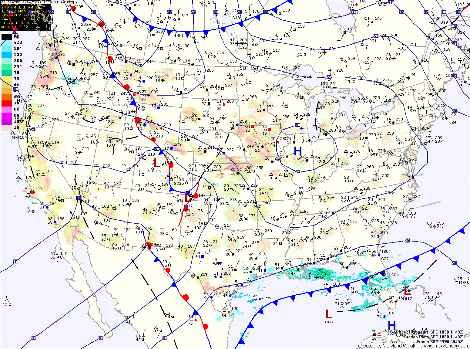
Current Surface MapHigh pressure will build into the region today, allowing for ample sunshine but also bringing colder air. Highs today will only top out around 40 degrees.
The high pressure will be replaced tomorrow as two pieces of energy phase off the Carolina coast and rapidly develop into a strong coastal storm. The storm will develop off the coast and will not impact the area.
However, as the two pieces of energy come together over our area, light precipitation is expected. It should be cold enough for mostly snow, but rain may mix in, especially along and east of I-95.
Any snow that falls will have an extremely tough time accumulating. Expect a coating to possibly a slushy inch, mainly on elevated surfaces and grassy areas. Highs tomorrow will be in the mid 30s.
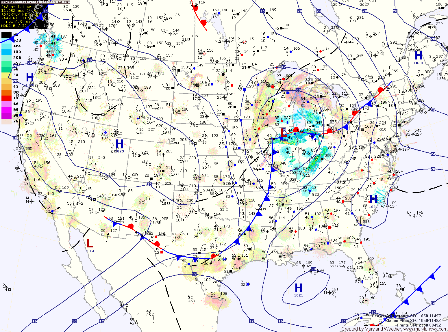
Current Surface MapA WINTER WEATHER ADVISORY is in effect this morning for: Allegany, Frederick and Washington counties.
Light showers are developing over the Blue Ridge. A Winter Weather Advisory for light freezing rain has been posted for that area as temperatures are near freezing. The showers will continue to develop and move eastward this morning and afternoon. Expect highs to reach the low to mid 40s.
The showers may continue into this evening and tonight before a cold front pushes through. The front will end the shower activity and clear the skies.
Tomorrow will be mostly sunny, breezy but warmer with highs pushing into the mid 50s.