Stationary Front Leads to Unsettled Week Ahead
Current Surface Map
Current Surface Map
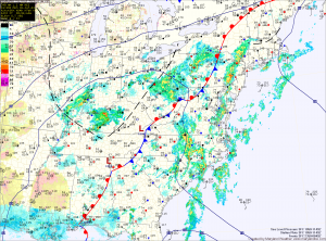
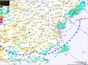
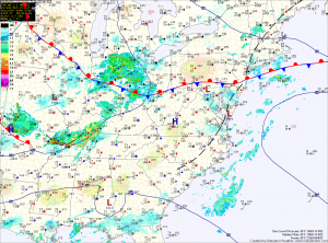
The frontal boundary that brought showers, storms and relief from the heat has stalled out in our area.

Several areas of low pressure will push through the region along the front bringing unsettled weather for much of the week.

Today will be mostly cloudy with highs in the mid 80s. Scattered showers and thunderstorms are likely this afternoon and evening. These storms could produce locally heavy rainfall.

Thunderstorm chances decrease slightly tomorrow, but isolated to scattered storms will still be possible. Highs will be in the mid to upper 80s.

More Showers and Storms; Pattern Shifts Tomorrow

Current Surface Map
Current Surface Map
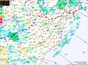
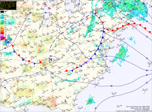
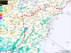
Low pressure remains to our west while high pressure remains to our east. The flow around them continues to send moisture up the east coast.

Today will be similar to the past few, with scattered showers and thunderstorms capable of producing locally heavy rainfall. Highs will be in the low to mid 80s.

The high pressure center will begin to move westward tonight. This will push the widespread shower and storm activity to our west tomorrow.

Expect a more typical summer day for the Fourth of July holiday. Highs will be around 90 degrees with a slight chance of a pop up afternoon thunderstorm.

Another Day of Showers and Storms

Current Surface Map
Current Surface Map
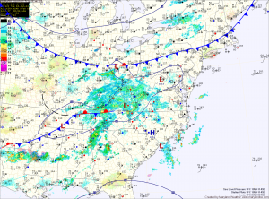
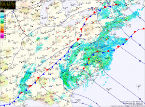
As this blocking pattern continues, another day of showers and storms is on tap. The good news is, after today, rain chances will gradually decrease.

Scattered showers are moving through the area at this time and this will continue into the afternoon. Additionally, with the afternoon heating, thunderstorms will also be possible.

Any shower or storm will be capable of producing locally heavy rainfall and flash flooding. A Flash Flood Watch is in effect for all of central Maryland. Highs today will be low 80s.

More Showers and Thunderstorms; Continued Flash Flood Threat

Current Surface Map
Current Surface Map
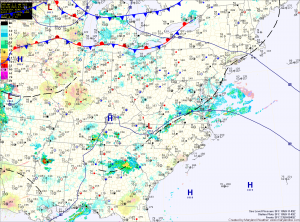
An upper low to our west remains blocked by high pressure off the coast. This will keep moist southerly flow locked into the region.

Batches of showers and thunderstorms will continue to move through the area today, bringing locally heavy rainfall. A Flash Flood Watch is in effect for the entire state, except for the mountains. Highs will be in the low to mid 80s.

Scattered showers will continue through tonight. Another round of showers and thunderstorms are likely tomorrow and tomorrow night. Highs will be in the low to mid 80s.

Continued Thunderstorm Threat

Current Surface Map
Current Surface Map
With a Bermuda High blocking things up, a stationary boundary will persist in the area through the weekend and into next week. This will keep thunderstorms in the forecast each day.

Today will become partly sunny with highs in the mid to upper 80s. Thunderstorms will develop this afternoon and persist into the evening.

Much of the same for tomorrow. Partly sunny skies, highs in the mid to upper 80s with afternoon and evening storms likely.

Storm coverage will decrease a bit on Sunday, but the threat still persists. Highs will be in the low to mid 80s.

Cloudy with Widespread Showers Today

Current Surface Map
Current Surface Map
Cloud cover will persist today as an area of low pressure moves by to our south. The clouds will keep temperatures down a bit, with highs only in the low 80s.

Additionally, showers will continue to build into the area by late morning and will persist through the day. A few embedded thunderstorms will also be possible this afternoon.

The rain will taper off tonight into tomorrow morning as the low departs the area. Highs tomorrow will be around 80 degrees under clearing skies.

Unsettled Start to the Week

Current Surface Map
Current Surface Map
Heat and humidity will continue to build into the area today. As it does so, a series of fronts in the region will kick off scattered showers and thunderstorms this afternoon. Highs today will be in the mid to upper 80s.

Tomorrow will be similar to today, with another round of afternoon showers and thunderstorms. It will be a little bit warmer than today, with highs around 90 degrees.

An area of low pressure will move by Tuesday night into Wednesday, keeping a chance of rain in the forecast into Wednesday morning. After that system moves by, high pressure and cooler air will move into to region for the remainder of the week. Highs on Wednesday will be in the low 80s.

Sprinkles this Morning; Decreasing Clouds this Afternoon

Current Surface Map
Current Surface Map
The front and storm system responsible for yesterday’s severe weather have move out of the area. Some left over sprinkles are currently affecting central and eastern Maryland but they will continue to slide through and will end over the next few hours.

Expect decreasing clouds this afternoon and highs in the upper 70s to around 80.

Tomorrow will be pleasant, with ample sunshine and highs in the low 80s with low humidity.

High pressure will slide off the Carolina coast Saturday night, setting up southerly flow while a cold front moves southward towards the area. This will cause temperatures to warm, humidity to increase and touch off an isolated afternoon shower or thunderstorm. Highs on Sunday will be in the mid 80s.

Partly Sunny Today; Slight Chance of a Shower

Current Surface Map
Current Surface Map
Today will offer a brief respite from the heavy rainfall events that have been affecting the area lately. A cold front is currently moving through the state and until it clears the area, a slight chance of showers exists.

The front should push off the coast by this afternoon, ending the rain threat. Highs today will be in the low to mid 80s under eventual partly sunny skies.

High pressure builds in briefly this afternoon and tonight before the next rain maker begins to take aim on the area. The cold front that is currently pushing through will stall out to our south and remain stationary through Thursday.

For tomorrow, thunderstorms over the midwest may ride along the boundary and affect our area during the afternoon and evening. These storms could be severe with damaging winds, heavy rainfall and isolated tornadoes. Highs will be in the mid to upper 80s.
TS Andrea to Bring Heavy Rain Today

Current Surface Map
Current Surface Map
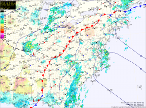
Tropical Storm Andrea will continue to move northeastward along a frontal boundary today and tonight, bringing heavy rainfall and scattered thunderstorms to the area. Highs today will be in the mid 70s.

Over an inch of rain has fallen across most of the state and another 2-3 inches with isolated spots over 4 are possible today and tonight. Consequently, a Flash Flood Watch is in effect for most of the state, east of the mountains through tonight.

Rain from Andrea will taper off around midnight tonight as the storm system races off to the northeast. Behind the system, warm, moist, tropical air will be left in place. This will set the stage for a muggy Saturday with scattered afternoon showers and thunderstorms. Highs will be around 80 degrees.