Becoming Warmer with Storms Likely this Afternoon
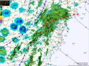
Showers and Storms, Severe Weather Likely This Afternoon


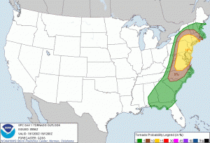
Expect rainfall to continue to build through the morning with thunderstorms developing after noon. The best chance for severe storms will be later this afternoon and evening as the front moves closer. Damaging winds, heavy rain and isolated tornadoes are possible. Please stay alert and check for watches and warnings as we move into the afternoon.
Partial Clearing This Morning; Afternoon Storms

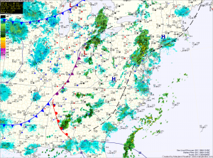
The current light rain and drizzle that is moving through the area will clear in the next few hours. This will allow partial clearing to occur, helping to destabilize the atmosphere. Thunderstorms will develop this afternoon over the mountains and move eastward into the evening.
Depending on how much clearing occurs, some of these storms could become severe with damaging winds, large hail and even an isolated tornado. Highs today will be in the mid 80s.
The cold front moves through tomorrow, bringing another round of showers and thunderstorms during the day. Highs will again be in the mid 80s.
